Xonrupt-Longemer geodata
Xonrupt-Longemer (Grand Est) is a populated place; located in France in Europe/Paris (GMT+2) time zone. With population of 1,542 people, there are 6046 cities with bigger population in this country. Compared to other cities in France, 60.8% of cities are located further ↓South; 94.4% of cities are located further ←West and 96.9% of cities have lower elevation than Xonrupt-Longemer. Note1
Administrative division(s):
- Level 1: Grand Est
- Level 2: Vosges
- Level 3: Arrondissement de Saint-Dié-des-Vosges
- Level 4: Xonrupt-Longemer


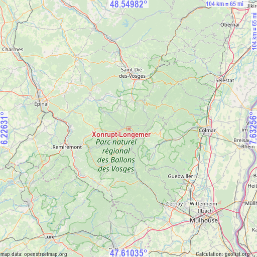
Xonrupt-Longemer GPS coordinates[2]
48° 4' 56.028" North, 6° 55' 45.984" East
| Map corner | latitude | longitude |
|---|---|---|
| Upper-left | 48.54982°, | 6.22631° |
| Center: | 48.08223°, | 6.92944° |
| Lower-right: | 47.61035°, | 7.63256° |
| Map W x H: | 104.5×104.5 km | = 64.9×64.9mi |
| max Lat: | 51.07786° ⇑39.2% North |
| Xonrupt-Longemer: | 48.08223° |
| min Lat: | ⇓60.8% South 41.3874° |
| min Long | Xonrupt-Longeme | max Long |
| -5.08615° | 6.92944° | 9.52242° |
| W 94.4%⇐ | ⇒5.6% E |
Elevation
Elevation of Xonrupt-Longemer is 719 m = 2359 ft, and this is 525.3 m = 1723 ft above average elevation for this country.
| Max E: |
2333 m = 7654 ft | 3.1% |
| Xonrupt-Longemer | 719 m 2359 ft | |
| Avg. | 193.7 m = 635 ft | |
Min E: |
-1 m = -3 ft | 96.9% |
See also: France elevation on elevation.city.
Geographical zone
Xonrupt-Longemer is located in North temperate zone (between Tropic of Cancer and the Arctic Circle). Distance of this North polar circle is 2054.9 km =1276.9 mi to North.| Distance of | km | miles | from Xonrupt-Longemer |
|---|---|---|---|
| North Pole | 4660.8 | 2896.1 | to North |
| Arctic Circle | 2054.9 | 1276.9 | to North |
| Tropic Cancer | 2740.3 | 1702.7 | to South |
| Equator | 5346.2 | 3322 | to South |


Nearby cities:
15 places around Xonrupt-Longemer: (largest is in red/bold)
• Anould
11.5 km =7.1 mi,  6°
6°
• Corcieux
10.6 km =6.6 mi,  340°
340°
• Fraize
12.7 km =7.9 mi,  23°
23°
• Gerbépal
7.5 km =4.7 mi,  355°
355°
• Granges-sur-Vologne
12.4 km =7.7 mi,  304°
304°
• Gérardmer
4 km =2.5 mi,  255°
255°
• La Bresse
10.3 km =6.4 mi,  207°
207°
• La Houssière
13.8 km =8.6 mi, 335°
• Le Tholy
13.8 km =8.6 mi,  270°
270°
• Metzeral
13.1 km =8.1 mi,  126°
126°
• Muhlbach-sur-Munster
13 km =8.1 mi,  119°
119°
• Plainfaing
11.9 km =7.4 mi,  32°
32°
• Rochesson
12.5 km =7.8 mi,  237°
237°
• Soultzeren
13 km =8.1 mi,  98°
98°
• Stosswihr
13 km =8.1 mi, 103°
Sources, notices
• [Note1] Compared only with cities in France existing in our database
• [Src1] Map data: © OpenStreetMap contributors (CC-BY-SA)
• [Src2] Other city data from geonames.org with taken over terms of usage.
• [Src3] Geographical zone / Annual Mean Temperature by Robert A. Rohde @ Wikipedia
