Granges-sur-Vologne geodata
Granges-sur-Vologne (Grand Est) is a populated place; located in France in Europe/Paris (GMT+2) time zone. With population of 2,492 people, there are 3902 cities with bigger population in this country. Compared to other cities in France, 61.9% of cities are located further ↓South; 93.6% of cities are located further ←West and 92.8% of cities have lower elevation than Granges-sur-Vologne. Note1
Administrative division(s):
- Level 1: Grand Est
- Level 2: Vosges
- Level 3: Arrondissement de Saint-Dié-des-Vosges
- Level 4: Granges-Aumontzey


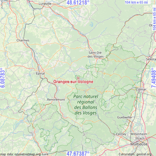
Granges-sur-Vologne GPS coordinates[2]
48° 8' 42.612" North, 6° 47' 27.42" East
| Map corner | latitude | longitude |
|---|---|---|
| Upper-left | 48.61218°, | 6.08783° |
| Center: | 48.14517°, | 6.79095° |
| Lower-right: | 47.67387°, | 7.49408° |
| Map W x H: | 104.3×104.3 km | = 64.8×64.8mi |
| max Lat: | 51.07786° ⇑38.1% North |
| Granges-sur-Vologne: | 48.14517° |
| min Lat: | ⇓61.9% South 41.3874° |
| min Long | Granges-sur-Vol | max Long |
| -5.08615° | 6.79095° | 9.52242° |
| W 93.6%⇐ | ⇒6.4% E |
Elevation
Elevation of Granges-sur-Vologne is 498 m = 1634 ft, and this is 304.3 m = 998 ft above average elevation for this country.
| Max E: |
2333 m = 7654 ft | 7.2% |
| Granges-sur-Vologne | 498 m 1634 ft | |
| Avg. | 193.7 m = 635 ft | |
Min E: |
-1 m = -3 ft | 92.8% |
See also: France elevation on elevation.city.
Geographical zone
Granges-sur-Vologne is located in North temperate zone (between Tropic of Cancer and the Arctic Circle). Distance of this North polar circle is 2047.9 km =1272.5 mi to North.| Distance of | km | miles | from Granges-sur-Vologne |
|---|---|---|---|
| North Pole | 4653.8 | 2891.7 | to North |
| Arctic Circle | 2047.9 | 1272.5 | to North |
| Tropic Cancer | 2747.3 | 1707.1 | to South |
| Equator | 5353.2 | 3326.3 | to South |


Nearby cities:
15 places around Granges-sur-Vologne: (largest is in red/bold)
• Anould
12.3 km =7.6 mi,  68°
68°
• Brouvelieures
11.1 km =6.9 mi,  336°
336°
• Bruyères
8.7 km =5.4 mi,  322°
322°
• Champ-le-Duc
7.6 km =4.7 mi, 317°
• Corcieux
7.4 km =4.6 mi, 65°
• Docelles
13.2 km =8.2 mi,  269°
269°
• Gerbépal
9.7 km =6 mi,  87°
87°
• Gérardmer
10.3 km =6.4 mi,  141°
141°
• La Forge
10.2 km =6.3 mi,  209°
209°
• La Houssière
7.2 km =4.5 mi,  39°
39°
• Laval-sur-Vologne
8.2 km =5.1 mi,  308°
308°
• Laveline-devant-Bruyères
5.5 km =3.4 mi,  332°
332°
• Le Tholy
7.8 km =4.8 mi, 206°
• Lépanges-sur-Vologne
9.5 km =5.9 mi,  284°
284°
• Xonrupt-Longemer
12.4 km =7.7 mi,  124°
124°
Sources, notices
• [Note1] Compared only with cities in France existing in our database
• [Src1] Map data: © OpenStreetMap contributors (CC-BY-SA)
• [Src2] Other city data from geonames.org with taken over terms of usage.
• [Src3] Geographical zone / Annual Mean Temperature by Robert A. Rohde @ Wikipedia
