Richwiller geodata
Richwiller (Grand Est) is a populated place; located in France in Europe/Paris (GMT+2) time zone. With population of 3,362 people, there are 2898 cities with bigger population in this country. Compared to other cities in France, 55.4% of cities are located further ↓South; 96.3% of cities are located further ←West and 74.6% of cities have lower elevation than Richwiller. Note1
Administrative division(s):
- Level 1: Grand Est
- Level 2: Haut-Rhin
- Level 3: Arrondissement de Mulhouse
- Level 4: Richwiller


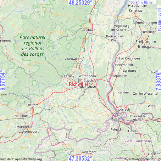
Richwiller GPS coordinates[2]
47° 46' 47.82" North, 7° 16' 50.412" East
| Map corner | latitude | longitude |
|---|---|---|
| Upper-left | 48.25029°, | 6.57754° |
| Center: | 47.77995°, | 7.28067° |
| Lower-right: | 47.30532°, | 7.98379° |
| Map W x H: | 105.1×105.1 km | = 65.3×65.3mi |
| max Lat: | 51.07786° ⇑44.6% North |
| Richwiller: | 47.77995° |
| min Lat: | ⇓55.4% South 41.3874° |
| min Long | Richwiller | max Long |
| -5.08615° | 7.28067° | 9.52242° |
| W 96.3%⇐ | ⇒3.7% E |
Elevation
Elevation of Richwiller is 246 m = 807 ft, and this is 52.3 m = 172 ft above average elevation for this country.
| Max E: |
2333 m = 7654 ft | 25.4% |
| Richwiller | 246 m 807 ft | |
| Avg. | 193.7 m = 635 ft | |
Min E: |
-1 m = -3 ft | 74.6% |
See also: France elevation on elevation.city.
Geographical zone
Richwiller is located in North temperate zone (between Tropic of Cancer and the Arctic Circle). Distance of this North polar circle is 2088.5 km =1297.7 mi to North.| Distance of | km | miles | from Richwiller |
|---|---|---|---|
| North Pole | 4694.4 | 2917 | to North |
| Arctic Circle | 2088.5 | 1297.7 | to North |
| Tropic Cancer | 2706.7 | 1681.9 | to South |
| Equator | 5312.6 | 3301.1 | to South |


Nearby cities:
15 places around Richwiller: (largest is in red/bold)
• Brunstatt
7.2 km =4.5 mi,  155°
155°
• Didenheim
7 km =4.3 mi,  167°
167°
• Heimsbrunn
7.2 km =4.5 mi,  214°
214°
• Illzach
5.3 km =3.3 mi,  96°
96°
• Kingersheim
3.6 km =2.2 mi,  70°
70°
• Lutterbach
2.2 km =1.4 mi,  180°
180°
• Morschwiller-le-Bas
4.9 km =3 mi,  189°
189°
• Mulhouse
4.7 km =2.9 mi,  130°
130°
• Pfastatt
2.1 km =1.3 mi, 125°
• Pulversheim
6.6 km =4.1 mi,  13°
13°
• Reiningue
4.7 km =2.9 mi,  228°
228°
• Sausheim
6.9 km =4.3 mi,  83°
83°
• Staffelfelden
5.6 km =3.5 mi,  337°
337°
• Wittelsheim
4.4 km =2.7 mi,  318°
318°
• Wittenheim
4.9 km =3 mi,  45°
45°
Sources, notices
• [Note1] Compared only with cities in France existing in our database
• [Src1] Map data: © OpenStreetMap contributors (CC-BY-SA)
• [Src2] Other city data from geonames.org with taken over terms of usage.
• [Src3] Geographical zone / Annual Mean Temperature by Robert A. Rohde @ Wikipedia
