Weyersheim geodata
Weyersheim (Grand Est) is a populated place; located in France in Europe/Paris (GMT+2) time zone. With population of 3,095 people, there are 3152 cities with bigger population in this country. Compared to other cities in France, 73.6% of cities are located further ↓South; 99.3% of cities are located further ←West and 52.5% of cities have lower elevation than Weyersheim. Note1
Administrative division(s):
- Level 1: Grand Est
- Level 2: Bas-Rhin
- Level 3: Arrondissement de Haguenau-Wissembourg
- Level 4: Weyersheim


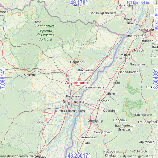
Weyersheim GPS coordinates[2]
48° 42' 58.392" North, 7° 48' 4.572" East
| Map corner | latitude | longitude |
|---|---|---|
| Upper-left | 49.178°, | 7.09814° |
| Center: | 48.71622°, | 7.80127° |
| Lower-right: | 48.25017°, | 8.50439° |
| Map W x H: | 103.2×103.2 km | = 64.1×64.1mi |
| max Lat: | 51.07786° ⇑26.4% North |
| Weyersheim: | 48.71622° |
| min Lat: | ⇓73.6% South 41.3874° |
| min Long | Weyersheim | max Long |
| -5.08615° | 7.80127° | 9.52242° |
| W 99.3%⇐ | ⇒0.7% E |
Elevation
Elevation of Weyersheim is 141 m = 463 ft, and this is 52.7 m = 173 ft below average elevation for this country.
| Max E: |
2333 m = 7654 ft | 47.5% |
| Avg. | 193.7 m = 635 ft | |
| Weyersheim | 141 m = 463 ft | |
Min E: |
-1 m = -3 ft | 52.5% |
See also: France elevation on elevation.city.
Geographical zone
Weyersheim is located in North temperate zone (between Tropic of Cancer and the Arctic Circle). Distance of this North polar circle is 1984.4 km =1233 mi to North.| Distance of | km | miles | from Weyersheim |
|---|---|---|---|
| North Pole | 4590.3 | 2852.3 | to North |
| Arctic Circle | 1984.4 | 1233 | to North |
| Tropic Cancer | 2810.8 | 1746.5 | to South |
| Equator | 5416.7 | 3365.8 | to South |


Nearby cities:
15 places around Weyersheim: (largest is in red/bold)
• Bischwiller
7 km =4.3 mi,  33°
33°
• Brumath
6.9 km =4.3 mi,  286°
286°
• Gambsheim
6.6 km =4.1 mi,  114°
114°
• Geudertheim
3.7 km =2.3 mi,  283°
283°
• Gries
4.3 km =2.7 mi,  12°
12°
• Herrlisheim
7.8 km =4.8 mi,  78°
78°
• Hœrdt
2.2 km =1.4 mi,  216°
216°
• Kilstett
5.9 km =3.7 mi,  138°
138°
• Kriegsheim
7.1 km =4.4 mi,  310°
310°
• Kurtzenhouse
2.7 km =1.7 mi, 5°
• La Wantzenau
6.8 km =4.2 mi,  161°
161°
• Niederschaeffolsheim
7.8 km =4.8 mi,  323°
323°
• Reichstett
8.3 km =5.2 mi,  204°
204°
• Vendenheim
8.5 km =5.3 mi,  232°
232°
• Weitbruch
4.6 km =2.9 mi,  339°
339°
Sources, notices
• [Note1] Compared only with cities in France existing in our database
• [Src1] Map data: © OpenStreetMap contributors (CC-BY-SA)
• [Src2] Other city data from geonames.org with taken over terms of usage.
• [Src3] Geographical zone / Annual Mean Temperature by Robert A. Rohde @ Wikipedia
