Brumath geodata
Brumath (Grand Est) is a populated place; located in France in Europe/Paris (GMT+2) time zone. With population of 9,459 people, there are 1012 cities with bigger population in this country. Compared to other cities in France, 74% of cities are located further ↓South; 99% of cities are located further ←West and 56.6% of cities have lower elevation than Brumath. Note1
Administrative division(s):
- Level 1: Grand Est
- Level 2: Bas-Rhin
- Level 3: Arrondissement de Haguenau-Wissembourg
- Level 4: Brumath


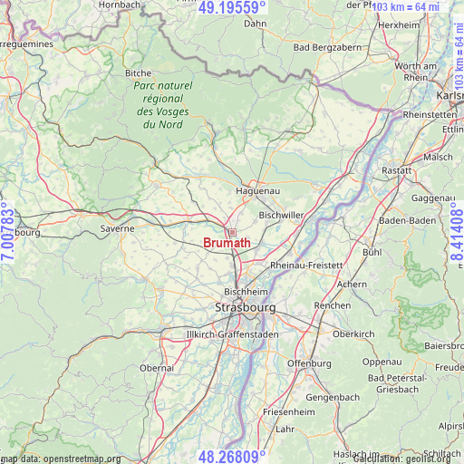
Brumath GPS coordinates[2]
48° 44' 2.328" North, 7° 42' 39.42" East
| Map corner | latitude | longitude |
|---|---|---|
| Upper-left | 49.19559°, | 7.00783° |
| Center: | 48.73398°, | 7.71095° |
| Lower-right: | 48.26809°, | 8.41408° |
| Map W x H: | 103.1×103.1 km | = 64.1×64.1mi |
| max Lat: | 51.07786° ⇑26% North |
| Brumath: | 48.73398° |
| min Lat: | ⇓74% South 41.3874° |
| min Long | Brumath | max Long |
| -5.08615° | 7.71095° | 9.52242° |
| W 99%⇐ | ⇒1% E |
Elevation
Elevation of Brumath is 156 m = 512 ft, and this is 37.7 m = 124 ft below average elevation for this country.
| Max E: |
2333 m = 7654 ft | 43.4% |
| Avg. | 193.7 m = 635 ft | |
| Brumath | 156 m = 512 ft | |
Min E: |
-1 m = -3 ft | 56.6% |
See also: France elevation on elevation.city.
Geographical zone
Brumath is located in North temperate zone (between Tropic of Cancer and the Arctic Circle). Distance of this North polar circle is 1982.5 km =1231.9 mi to North.| Distance of | km | miles | from Brumath |
|---|---|---|---|
| North Pole | 4588.4 | 2851.1 | to North |
| Arctic Circle | 1982.5 | 1231.9 | to North |
| Tropic Cancer | 2812.8 | 1747.8 | to South |
| Equator | 5418.7 | 3367 | to South |


Nearby cities:
15 places around Brumath: (largest is in red/bold)
• Batzendorf
5.5 km =3.4 mi,  356°
356°
• Bernolsheim
2.9 km =1.8 mi,  326°
326°
• Eckwersheim
5.9 km =3.7 mi,  190°
190°
• Geudertheim
3.2 km =2 mi,  110°
110°
• Hœrdt
6.5 km =4 mi,  125°
125°
• Kriegsheim
3 km =1.9 mi,  25°
25°
• Mittelhausen
6.6 km =4.1 mi,  245°
245°
• Mommenheim
5.5 km =3.4 mi,  298°
298°
• Niederschaeffolsheim
4.7 km =2.9 mi, 25°
• Olwisheim
4.9 km =3 mi,  212°
212°
• Waltenheim-sur-Zorn
6.2 km =3.9 mi,  283°
283°
• Weitbruch
5.5 km =3.4 mi,  65°
65°
• Wingersheim
5.8 km =3.6 mi,  256°
256°
• Wintershouse
6.5 km =4 mi,  353°
353°
• Wittersheim
6.6 km =4.1 mi,  323°
323°
Sources, notices
• [Note1] Compared only with cities in France existing in our database
• [Src1] Map data: © OpenStreetMap contributors (CC-BY-SA)
• [Src2] Other city data from geonames.org with taken over terms of usage.
• [Src3] Geographical zone / Annual Mean Temperature by Robert A. Rohde @ Wikipedia
