Niederschaeffolsheim geodata
Niederschaeffolsheim (Grand Est) is a populated place; located in France in Europe/Paris (GMT+2) time zone. With population of 1,341 people, there are 6861 cities with bigger population in this country. Compared to other cities in France, 74.9% of cities are located further ↓South; 99.1% of cities are located further ←West and 62.9% of cities have lower elevation than Niederschaeffolsheim. Note1
Administrative division(s):
- Level 1: Grand Est
- Level 2: Bas-Rhin
- Level 3: Arrondissement de Haguenau-Wissembourg
- Level 4: Niederschaeffolsheim
Current local time in Niederschaeffolsheim:
01:39 PM, WednesdayDifference from your time zone: hours


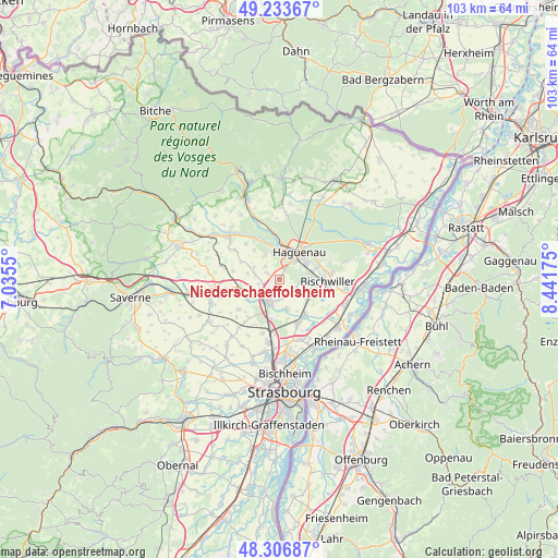
Niederschaeffolsheim GPS coordinates[2]
48° 46' 20.676" North, 7° 44' 19.032" East
| Map corner | latitude | longitude |
|---|---|---|
| Upper-left | 49.23367°, | 7.0355° |
| Center: | 48.77241°, | 7.73862° |
| Lower-right: | 48.30687°, | 8.44175° |
| Map W x H: | 103.1×10³ km | = 64.1×64mi |
| max Lat: | 51.07786° ⇑25.1% North |
| Niederschaeffolsheim: | 48.77241° |
| min Lat: | ⇓74.9% South 41.3874° |
| min Long | Niederschaeffol | max Long |
| -5.08615° | 7.73862° | 9.52242° |
| W 99.1%⇐ | ⇒0.90000000000001% E |
Elevation
Elevation of Niederschaeffolsheim is 184 m = 604 ft, and this is 9.7 m = 32 ft below average elevation for this country.
| Max E: |
2333 m = 7654 ft | 37.1% |
| Avg. | 193.7 m = 635 ft | |
| Niederschaeffolsheim | 184 m = 604 ft | |
Min E: |
-1 m = -3 ft | 62.9% |
See also: France elevation on elevation.city.
Geographical zone
Niederschaeffolsheim is located in North temperate zone (between Tropic of Cancer and the Arctic Circle). Distance of this North polar circle is 1978.2 km =1229.2 mi to North.| Distance of | km | miles | from Niederschaeffolsheim |
|---|---|---|---|
| North Pole | 4584.1 | 2848.4 | to North |
| Arctic Circle | 1978.2 | 1229.2 | to North |
| Tropic Cancer | 2817.1 | 1750.5 | to South |
| Equator | 5423 | 3369.7 | to South |


Nearby cities:
15 places around Niederschaeffolsheim: (largest is in red/bold)
• Batzendorf
2.7 km =1.7 mi,  297°
297°
• Bernolsheim
4.1 km =2.5 mi,  242°
242°
• Brumath
4.7 km =2.9 mi,  205°
205°
• Geudertheim
5.5 km =3.4 mi,  169°
169°
• Gries
5.9 km =3.7 mi,  110°
110°
• Haguenau
6.1 km =3.8 mi,  38°
38°
• Kaltenhouse
7.2 km =4.5 mi,  73°
73°
• Kriegsheim
1.8 km =1.1 mi,  204°
204°
• Kurtzenhouse
6 km =3.7 mi,  126°
126°
• Mommenheim
7.1 km =4.4 mi,  256°
256°
• Ohlungen
5.3 km =3.3 mi,  329°
329°
• Schweighouse-sur-Moder
5.4 km =3.4 mi,  351°
351°
• Weitbruch
3.6 km =2.2 mi,  123°
123°
• Wintershouse
3.6 km =2.2 mi,  308°
308°
• Wittersheim
6 km =3.7 mi,  280°
280°
Sources, notices
• [Note1] Compared only with cities in France existing in our database
• [Src1] Map data: © OpenStreetMap contributors (CC-BY-SA)
• [Src2] Other city data from geonames.org with taken over terms of usage.
• [Src3] Geographical zone / Annual Mean Temperature by Robert A. Rohde @ Wikipedia
