Geudertheim geodata
Geudertheim (Grand Est) is a populated place; located in France in Europe/Paris (GMT+2) time zone. With population of 2,364 people, there are 4090 cities with bigger population in this country. Compared to other cities in France, 73.8% of cities are located further ↓South; 99.2% of cities are located further ←West and 55% of cities have lower elevation than Geudertheim. Note1
Administrative division(s):
- Level 1: Grand Est
- Level 2: Bas-Rhin
- Level 3: Arrondissement de Haguenau-Wissembourg
- Level 4: Geudertheim


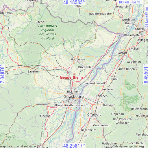
Geudertheim GPS coordinates[2]
48° 43' 26.94" North, 7° 45' 6.768" East
| Map corner | latitude | longitude |
|---|---|---|
| Upper-left | 49.18585°, | 7.04876° |
| Center: | 48.72415°, | 7.75188° |
| Lower-right: | 48.25817°, | 8.45501° |
| Map W x H: | 103.1×103.1 km | = 64.1×64.1mi |
| max Lat: | 51.07786° ⇑26.2% North |
| Geudertheim: | 48.72415° |
| min Lat: | ⇓73.8% South 41.3874° |
| min Long | Geudertheim | max Long |
| -5.08615° | 7.75188° | 9.52242° |
| W 99.2%⇐ | ⇒0.8% E |
Elevation
Elevation of Geudertheim is 150 m = 492 ft, and this is 43.7 m = 143 ft below average elevation for this country.
| Max E: |
2333 m = 7654 ft | 45% |
| Avg. | 193.7 m = 635 ft | |
| Geudertheim | 150 m = 492 ft | |
Min E: |
-1 m = -3 ft | 55% |
See also: France elevation on elevation.city.
Geographical zone
Geudertheim is located in North temperate zone (between Tropic of Cancer and the Arctic Circle). Distance of this North polar circle is 1983.6 km =1232.6 mi to North.| Distance of | km | miles | from Geudertheim |
|---|---|---|---|
| North Pole | 4589.4 | 2851.7 | to North |
| Arctic Circle | 1983.6 | 1232.6 | to North |
| Tropic Cancer | 2811.7 | 1747.1 | to South |
| Equator | 5417.6 | 3366.3 | to South |


Nearby cities:
15 places around Geudertheim: (largest is in red/bold)
• Batzendorf
7.4 km =4.6 mi,  333°
333°
• Bernolsheim
5.8 km =3.6 mi,  307°
307°
• Brumath
3.2 km =2 mi,  290°
290°
• Eckwersheim
6.2 km =3.9 mi,  220°
220°
• Gries
5.6 km =3.5 mi,  54°
54°
• Hœrdt
3.5 km =2.2 mi,  139°
139°
• Kriegsheim
4.1 km =2.5 mi,  335°
335°
• Kurtzenhouse
4.2 km =2.6 mi,  65°
65°
• Niederschaeffolsheim
5.5 km =3.4 mi,  349°
349°
• Olwisheim
6.4 km =4 mi,  241°
241°
• Reichstett
8.4 km =5.2 mi,  178°
178°
• Vendenheim
6.8 km =4.2 mi,  206°
206°
• Weitbruch
3.9 km =2.4 mi,  30°
30°
• Weyersheim
3.7 km =2.3 mi,  103°
103°
• Wintershouse
8.5 km =5.3 mi, 333°
Sources, notices
• [Note1] Compared only with cities in France existing in our database
• [Src1] Map data: © OpenStreetMap contributors (CC-BY-SA)
• [Src2] Other city data from geonames.org with taken over terms of usage.
• [Src3] Geographical zone / Annual Mean Temperature by Robert A. Rohde @ Wikipedia
