Kurtzenhouse geodata
Kurtzenhouse (Grand Est) is a populated place; located in France in Europe/Paris (GMT+2) time zone. With population of 934 people, there are 9351 cities with bigger population in this country. Compared to other cities in France, 74.1% of cities are located further ↓South; 99.3% of cities are located further ←West and 52.2% of cities have lower elevation than Kurtzenhouse. Note1
Administrative division(s):
- Level 1: Grand Est
- Level 2: Bas-Rhin
- Level 3: Arrondissement de Haguenau-Wissembourg
- Level 4: Kurtzenhouse


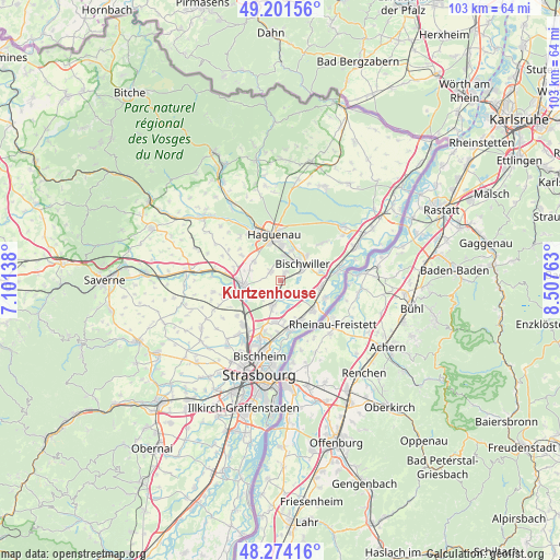
Kurtzenhouse GPS coordinates[2]
48° 44' 24" North, 7° 48' 16.2" East
| Map corner | latitude | longitude |
|---|---|---|
| Upper-left | 49.20156°, | 7.10138° |
| Center: | 48.74°, | 7.8045° |
| Lower-right: | 48.27416°, | 8.50763° |
| Map W x H: | 103.1×103.1 km | = 64.1×64.1mi |
| max Lat: | 51.07786° ⇑25.9% North |
| Kurtzenhouse: | 48.74° |
| min Lat: | ⇓74.1% South 41.3874° |
| min Long | Kurtzenhouse | max Long |
| -5.08615° | 7.8045° | 9.52242° |
| W 99.3%⇐ | ⇒0.7% E |
Elevation
Elevation of Kurtzenhouse is 140 m = 459 ft, and this is 53.7 m = 176 ft below average elevation for this country.
| Max E: |
2333 m = 7654 ft | 47.8% |
| Avg. | 193.7 m = 635 ft | |
| Kurtzenhouse | 140 m = 459 ft | |
Min E: |
-1 m = -3 ft | 52.2% |
See also: France elevation on elevation.city.
Geographical zone
Kurtzenhouse is located in North temperate zone (between Tropic of Cancer and the Arctic Circle). Distance of this North polar circle is 1981.8 km =1231.4 mi to North.| Distance of | km | miles | from Kurtzenhouse |
|---|---|---|---|
| North Pole | 4587.7 | 2850.7 | to North |
| Arctic Circle | 1981.8 | 1231.4 | to North |
| Tropic Cancer | 2813.5 | 1748.2 | to South |
| Equator | 5419.4 | 3367.5 | to South |


Nearby cities:
15 places around Kurtzenhouse: (largest is in red/bold)
• Bischwiller
4.8 km =3 mi,  49°
49°
• Brumath
6.9 km =4.3 mi,  264°
264°
• Gambsheim
7.8 km =4.8 mi,  132°
132°
• Geudertheim
4.2 km =2.6 mi,  245°
245°
• Gries
1.7 km =1.1 mi,  24°
24°
• Haguenau
8.5 km =5.3 mi,  353°
353°
• Herrlisheim
7.5 km =4.7 mi,  98°
98°
• Hœrdt
4.7 km =2.9 mi,  199°
199°
• Kaltenhouse
6 km =3.7 mi, 19°
• Kilstett
8 km =5 mi,  152°
152°
• Kriegsheim
5.9 km =3.7 mi,  289°
289°
• Niederschaeffolsheim
6 km =3.7 mi,  306°
306°
• Oberhoffen-sur-Moder
6.5 km =4 mi,  41°
41°
• Weitbruch
2.5 km =1.6 mi, 311°
• Weyersheim
2.7 km =1.7 mi,  185°
185°
Sources, notices
• [Note1] Compared only with cities in France existing in our database
• [Src1] Map data: © OpenStreetMap contributors (CC-BY-SA)
• [Src2] Other city data from geonames.org with taken over terms of usage.
• [Src3] Geographical zone / Annual Mean Temperature by Robert A. Rohde @ Wikipedia
