Gries geodata
Gries (Grand Est) is a populated place; located in France in Europe/Paris (GMT+2) time zone. With population of 2,831 people, there are 3444 cities with bigger population in this country. Compared to other cities in France, 74.4% of cities are located further ↓South; 99.3% of cities are located further ←West and 53.1% of cities have lower elevation than Gries. Note1
Administrative division(s):
- Level 1: Grand Est
- Level 2: Bas-Rhin
- Level 3: Arrondissement de Haguenau-Wissembourg
- Level 4: Gries


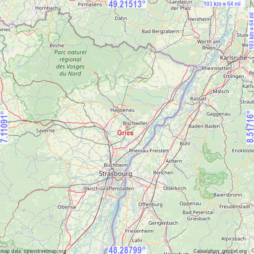
Gries GPS coordinates[2]
48° 45' 13.32" North, 7° 48' 50.508" East
| Map corner | latitude | longitude |
|---|---|---|
| Upper-left | 49.21513°, | 7.11091° |
| Center: | 48.7537°, | 7.81403° |
| Lower-right: | 48.28799°, | 8.51716° |
| Map W x H: | 103.1×103.1 km | = 64.1×64.1mi |
| max Lat: | 51.07786° ⇑25.6% North |
| Gries: | 48.7537° |
| min Lat: | ⇓74.4% South 41.3874° |
| min Long | Gries | max Long |
| -5.08615° | 7.81403° | 9.52242° |
| W 99.3%⇐ | ⇒0.7% E |
Elevation
Elevation of Gries is 143 m = 469 ft, and this is 50.7 m = 166 ft below average elevation for this country.
| Max E: |
2333 m = 7654 ft | 46.9% |
| Avg. | 193.7 m = 635 ft | |
| Gries | 143 m = 469 ft | |
Min E: |
-1 m = -3 ft | 53.1% |
See also: France elevation on elevation.city.
Geographical zone
Gries is located in North temperate zone (between Tropic of Cancer and the Arctic Circle). Distance of this North polar circle is 1980.3 km =1230.5 mi to North.| Distance of | km | miles | from Gries |
|---|---|---|---|
| North Pole | 4586.2 | 2849.7 | to North |
| Arctic Circle | 1980.3 | 1230.5 | to North |
| Tropic Cancer | 2815 | 1749.2 | to South |
| Equator | 5420.9 | 3368.4 | to South |


Nearby cities:
15 places around Gries: (largest is in red/bold)
• Batzendorf
8.5 km =5.3 mi,  292°
292°
• Bischwiller
3.4 km =2.1 mi,  61°
61°
• Brumath
7.9 km =4.9 mi,  253°
253°
• Gambsheim
8.5 km =5.3 mi,  143°
143°
• Geudertheim
5.6 km =3.5 mi,  234°
234°
• Haguenau
7.1 km =4.4 mi,  345°
345°
• Herrlisheim
7.2 km =4.5 mi,  111°
111°
• Hœrdt
6.4 km =4 mi,  200°
200°
• Kaltenhouse
4.4 km =2.7 mi,  17°
17°
• Kriegsheim
6.3 km =3.9 mi,  274°
274°
• Kurtzenhouse
1.7 km =1.1 mi, 204°
• Niederschaeffolsheim
5.9 km =3.7 mi, 290°
• Oberhoffen-sur-Moder
4.9 km =3 mi,  47°
47°
• Weitbruch
2.5 km =1.6 mi, 272°
• Weyersheim
4.3 km =2.7 mi,  192°
192°
Sources, notices
• [Note1] Compared only with cities in France existing in our database
• [Src1] Map data: © OpenStreetMap contributors (CC-BY-SA)
• [Src2] Other city data from geonames.org with taken over terms of usage.
• [Src3] Geographical zone / Annual Mean Temperature by Robert A. Rohde @ Wikipedia
