Neauphlette geodata
Neauphlette (Île-de-France) is a populated place; located in France in Europe/Paris (GMT+2) time zone. With population of 847 people, there are 10113 cities with bigger population in this country. Compared to other cities in France, 78.2% of cities are located further ↓South; 62.7% of cities are located further →East and 54.8% of cities have higher elevation than Neauphlette. Note1
Administrative division(s):
- Level 1: Île-de-France
- Level 2: Yvelines
- Level 3: Arrondissement de Mantes-la-Jolie
- Level 4: Neauphlette


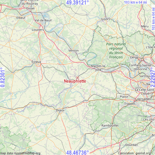
Neauphlette GPS coordinates[2]
48° 55' 53.112" North, 1° 31' 34.104" East
| Map corner | latitude | longitude |
|---|---|---|
| Upper-left | 49.39121°, | 0.82301° |
| Center: | 48.93142°, | 1.52614° |
| Lower-right: | 48.46736°, | 2.22927° |
| Map W x H: | 102.7×102.7 km | = 63.8×63.8mi |
| max Lat: | 51.07786° ⇑21.8% North |
| Neauphlette: | 48.93142° |
| min Lat: | ⇓78.2% South 41.3874° |
| min Long | Neauphlette | max Long |
| -5.08615° | 1.52614° | 9.52242° |
| W 37.3%⇐ | ⇒62.7% E |
Elevation
Elevation of Neauphlette is 117 m = 384 ft, and this is 76.7 m = 252 ft below average elevation for this country.
| Max E: |
2333 m = 7654 ft | 54.8% |
| Avg. | 193.7 m = 635 ft | |
| Neauphlette | 117 m = 384 ft | |
Min E: |
-1 m = -3 ft | 45.2% |
See also: France elevation on elevation.city.
Geographical zone
Neauphlette is located in North temperate zone (between Tropic of Cancer and the Arctic Circle). Distance of this North polar circle is 1960.5 km =1218.2 mi to North.| Distance of | km | miles | from Neauphlette |
|---|---|---|---|
| North Pole | 4566.4 | 2837.4 | to North |
| Arctic Circle | 1960.5 | 1218.2 | to North |
| Tropic Cancer | 2834.7 | 1761.4 | to South |
| Equator | 5440.7 | 3380.7 | to South |


Nearby cities:
15 places around Neauphlette: (largest is in red/bold)
• Boissy-Mauvoisin
5.2 km =3.2 mi,  47°
47°
• Breuilpont
8 km =5 mi,  297°
297°
• Bréval
1.6 km =1 mi,  18°
18°
• Bueil
6.1 km =3.8 mi,  270°
270°
• Dammartin-en-Serve
7.5 km =4.7 mi,  114°
114°
• Garennes-sur-Eure
6.8 km =4.2 mi,  250°
250°
• Gilles
2.3 km =1.4 mi,  201°
201°
• Guainville
3 km =1.9 mi,  237°
237°
• Ivry-la-Bataille
7.2 km =4.5 mi,  222°
222°
• La Couture-Boussey
9.7 km =6 mi, 245°
• La Villeneuve-en-Chevrie
9.3 km =5.8 mi,  0°
0°
• Lommoye
7 km =4.3 mi,  352°
352°
• Longnes
4.6 km =2.9 mi, 105°
• Oulins
8.5 km =5.3 mi,  208°
208°
• Villiers-en-Désœuvre
2.8 km =1.7 mi,  317°
317°
Sources, notices
• [Note1] Compared only with cities in France existing in our database
• [Src1] Map data: © OpenStreetMap contributors (CC-BY-SA)
• [Src2] Other city data from geonames.org with taken over terms of usage.
• [Src3] Geographical zone / Annual Mean Temperature by Robert A. Rohde @ Wikipedia
