Saulx geodata
Saulx (Bourgogne-Franche-Comté) is a populated place; located in France in Europe/Paris (GMT+2) time zone. With population of 700 people, there are 11801 cities with bigger population in this country. Compared to other cities in France, 54.2% of cities are located further ↓South; 90% of cities are located further ←West and 80.1% of cities have lower elevation than Saulx. Note1
Administrative division(s):
- Level 1: Bourgogne-Franche-Comté
- Level 2: Département de la Haute-Saône
- Level 3: Arrondissement de Lure
- Level 4: Saulx


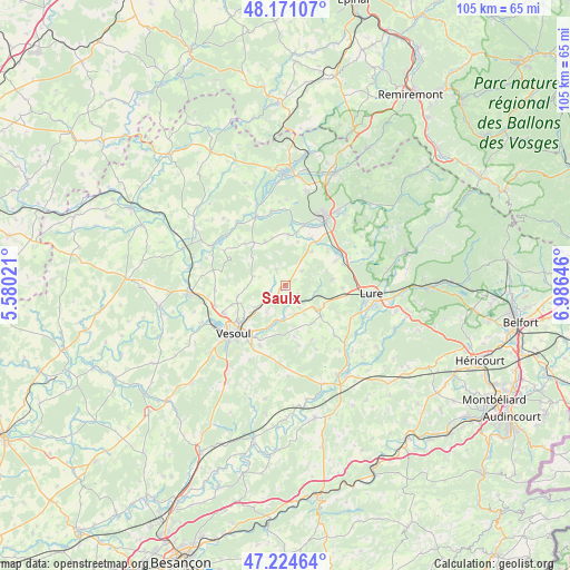
Saulx GPS coordinates[2]
47° 42' 0" North, 6° 16' 59.988" East
| Map corner | latitude | longitude |
|---|---|---|
| Upper-left | 48.17107°, | 5.58021° |
| Center: | 47.7°, | 6.28333° |
| Lower-right: | 47.22464°, | 6.98646° |
| Map W x H: | 105.2×105.2 km | = 65.4×65.4mi |
| max Lat: | 51.07786° ⇑45.8% North |
| Saulx: | 47.7° |
| min Lat: | ⇓54.2% South 41.3874° |
| min Long | Saulx | max Long |
| -5.08615° | 6.28333° | 9.52242° |
| W 90%⇐ | ⇒10% E |
Elevation
Elevation of Saulx is 291 m = 955 ft, and this is 97.3 m = 319 ft above average elevation for this country.
| Max E: |
2333 m = 7654 ft | 19.9% |
| Saulx | 291 m 955 ft | |
| Avg. | 193.7 m = 635 ft | |
Min E: |
-1 m = -3 ft | 80.1% |
See also: France elevation on elevation.city.
Geographical zone
Saulx is located in North temperate zone (between Tropic of Cancer and the Arctic Circle). Distance of this North polar circle is 2097.4 km =1303.3 mi to North.| Distance of | km | miles | from Saulx |
|---|---|---|---|
| North Pole | 4703.3 | 2922.5 | to North |
| Arctic Circle | 2097.4 | 1303.3 | to North |
| Tropic Cancer | 2697.8 | 1676.3 | to South |
| Equator | 5303.7 | 3295.6 | to South |


Nearby cities:
15 places around Saulx: (largest is in red/bold)
• Baudoncourt
9.9 km =6.2 mi,  28°
28°
• Breuches
11.5 km =7.1 mi,  17°
17°
• Breurey-lès-Faverney
13 km =8.1 mi,  298°
298°
• Citers
10.5 km =6.5 mi,  63°
63°
• Conflans-sur-Lanterne
13.9 km =8.6 mi,  338°
338°
• Frotey-lès-Vesoul
11.3 km =7 mi,  218°
218°
• Luxeuil-les-Bains
14.4 km =8.9 mi, 25°
• Magny-Vernois
14.8 km =9.2 mi,  103°
103°
• Navenne
13.6 km =8.5 mi, 221°
• Pusey
12.9 km =8 mi,  245°
245°
• Quincey
12.3 km =7.6 mi, 216°
• Saint-Sauveur
14 km =8.7 mi, 33°
• Vesoul
13.4 km =8.3 mi,  232°
232°
• Villers-le-Sec
12.2 km =7.6 mi,  202°
202°
• Vy-lès-Lure
13.5 km =8.4 mi,  116°
116°
Sources, notices
• [Note1] Compared only with cities in France existing in our database
• [Src1] Map data: © OpenStreetMap contributors (CC-BY-SA)
• [Src2] Other city data from geonames.org with taken over terms of usage.
• [Src3] Geographical zone / Annual Mean Temperature by Robert A. Rohde @ Wikipedia
