Villers-Cotterêts geodata
Villers-Cotterêts (Hauts-de-France) is a populated place; located in France in Europe/Paris (GMT+2) time zone. With population of 10,068 people, there are 946 cities with bigger population in this country. Compared to other cities in France, 85.2% of cities are located further ↓South; 59.1% of cities are located further ←West and 50.1% of cities have lower elevation than Villers-Cotterêts. Note1
Administrative division(s):
- Level 1: Hauts-de-France
- Level 2: Département de l'Aisne
- Level 3: Arrondissement de Soissons
- Level 4: Villers-Cotterêts


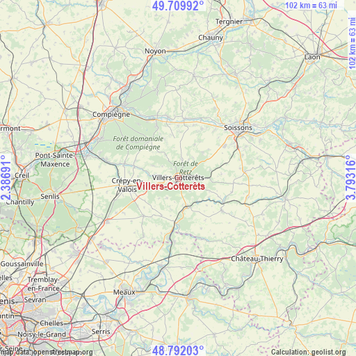
Villers-Cotterêts GPS coordinates[2]
49° 15' 11.196" North, 3° 5' 24.108" East
| Map corner | latitude | longitude |
|---|---|---|
| Upper-left | 49.70992°, | 2.38691° |
| Center: | 49.25311°, | 3.09003° |
| Lower-right: | 48.79203°, | 3.79316° |
| Map W x H: | 102.1×102.1 km | = 63.4×63.4mi |
| max Lat: | 51.07786° ⇑14.8% North |
| Villers-Cotterêts: | 49.25311° |
| min Lat: | ⇓85.2% South 41.3874° |
| min Long | Villers-Cotter� | max Long |
| -5.08615° | 3.09003° | 9.52242° |
| W 59.1%⇐ | ⇒40.9% E |
Elevation
Elevation of Villers-Cotterêts is 132 m = 433 ft, and this is 61.7 m = 202 ft below average elevation for this country.
| Max E: |
2333 m = 7654 ft | 49.9% |
| Avg. | 193.7 m = 635 ft | |
| Villers-Cotterêts | 132 m = 433 ft | |
Min E: |
-1 m = -3 ft | 50.1% |
See also: France elevation on elevation.city.
Geographical zone
Villers-Cotterêts is located in North temperate zone (between Tropic of Cancer and the Arctic Circle). Distance of this North polar circle is 1924.7 km =1196 mi to North.| Distance of | km | miles | from Villers-Cotterêts |
|---|---|---|---|
| North Pole | 4530.6 | 2815.2 | to North |
| Arctic Circle | 1924.7 | 1196 | to North |
| Tropic Cancer | 2870.5 | 1783.6 | to South |
| Equator | 5476.4 | 3402.9 | to South |


Nearby cities:
15 places around Villers-Cotterêts: (largest is in red/bold)
• Betz
14.6 km =9.1 mi,  221°
221°
• Bonneuil-en-Valois
8 km =5 mi,  296°
296°
• Crépy-en-Valois
14.8 km =9.2 mi,  261°
261°
• Fresnoy-la-Rivière
13 km =8.1 mi,  286°
286°
• Haramont
3.5 km =2.2 mi,  323°
323°
• La Ferté-Milon
9.2 km =5.7 mi,  162°
162°
• Lévignen
13.9 km =8.6 mi,  244°
244°
• Mareuil-sur-Ourcq
12.9 km =8 mi,  183°
183°
• Marolles
9.3 km =5.8 mi,  173°
173°
• Montigny-Lengrain
13.2 km =8.2 mi,  2°
2°
• Morienval
13.2 km =8.2 mi, 291°
• Pierrefonds
13.4 km =8.3 mi, 322°
• Ressons-le-Long
15.6 km =9.7 mi,  15°
15°
• Vauciennes
4.8 km =3 mi,  245°
245°
• Vaumoise
8.2 km =5.1 mi, 255°
Sources, notices
• [Note1] Compared only with cities in France existing in our database
• [Src1] Map data: © OpenStreetMap contributors (CC-BY-SA)
• [Src2] Other city data from geonames.org with taken over terms of usage.
• [Src3] Geographical zone / Annual Mean Temperature by Robert A. Rohde @ Wikipedia
