La Ferté-Milon geodata
La Ferté-Milon (Hauts-de-France) is a populated place; located in France in Europe/Paris (GMT+2) time zone. With population of 2,359 people, there are 4098 cities with bigger population in this country. Compared to other cities in France, 83.8% of cities are located further ↓South; 59.7% of cities are located further ←West and 61.5% of cities have higher elevation than La Ferté-Milon. Note1
Administrative division(s):
- Level 1: Hauts-de-France
- Level 2: Département de l'Aisne
- Level 3: Arrondissement de Soissons
- Level 4: La Ferté-Milon


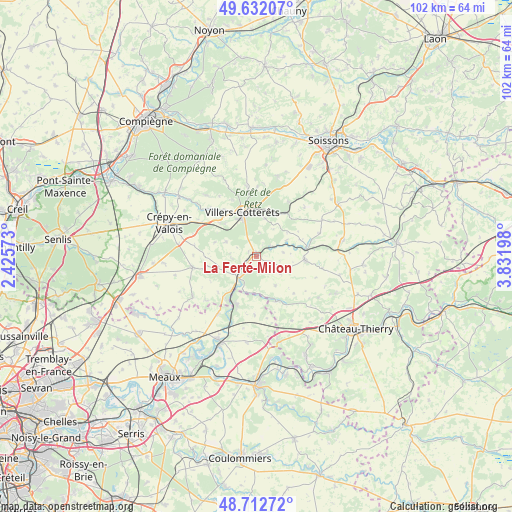
La Ferté-Milon GPS coordinates[2]
49° 10' 28.308" North, 3° 7' 43.86" East
| Map corner | latitude | longitude |
|---|---|---|
| Upper-left | 49.63207°, | 2.42573° |
| Center: | 49.17453°, | 3.12885° |
| Lower-right: | 48.71272°, | 3.83198° |
| Map W x H: | 102.2×102.2 km | = 63.5×63.5mi |
| max Lat: | 51.07786° ⇑16.2% North |
| La Ferté-Milon: | 49.17453° |
| min Lat: | ⇓83.8% South 41.3874° |
| min Long | La Ferté-Milon | max Long |
| -5.08615° | 3.12885° | 9.52242° |
| W 59.7%⇐ | ⇒40.3% E |
Elevation
Elevation of La Ferté-Milon is 98 m = 322 ft, and this is 95.7 m = 314 ft below average elevation for this country.
| Max E: |
2333 m = 7654 ft | 61.5% |
| Avg. | 193.7 m = 635 ft | |
| La Ferté-Milon | 98 m = 322 ft | |
Min E: |
-1 m = -3 ft | 38.5% |
See also: France elevation on elevation.city.
Geographical zone
La Ferté-Milon is located in North temperate zone (between Tropic of Cancer and the Arctic Circle). Distance of this North polar circle is 1933.5 km =1201.4 mi to North.| Distance of | km | miles | from La Ferté-Milon |
|---|---|---|---|
| North Pole | 4539.4 | 2820.7 | to North |
| Arctic Circle | 1933.5 | 1201.4 | to North |
| Tropic Cancer | 2861.8 | 1778.2 | to South |
| Equator | 5467.7 | 3397.5 | to South |


Nearby cities:
15 places around La Ferté-Milon: (largest is in red/bold)
• Acy-en-Multien
14.8 km =9.2 mi,  238°
238°
• Betz
12.8 km =8 mi,  260°
260°
• Coulombs-en-Valois
12 km =7.5 mi,  178°
178°
• Crouy-sur-Ourcq
10.2 km =6.3 mi,  202°
202°
• Gandelu
9.8 km =6.1 mi,  155°
155°
• Haramont
12.5 km =7.8 mi,  337°
337°
• Mareuil-sur-Ourcq
5.5 km =3.4 mi,  221°
221°
• Marolles
1.8 km =1.1 mi, 255°
• May-en-Multien
13.7 km =8.5 mi,  214°
214°
• Neuilly-Saint-Front
9.8 km =6.1 mi,  92°
92°
• Rouvres-en-Multien
9.5 km =5.9 mi,  227°
227°
• Vauciennes
9.9 km =6.2 mi,  313°
313°
• Vaumoise
12.7 km =7.9 mi,  302°
302°
• Vendrest
14.5 km =9 mi,  190°
190°
• Villers-Cotterêts
9.2 km =5.7 mi, 342°
Sources, notices
• [Note1] Compared only with cities in France existing in our database
• [Src1] Map data: © OpenStreetMap contributors (CC-BY-SA)
• [Src2] Other city data from geonames.org with taken over terms of usage.
• [Src3] Geographical zone / Annual Mean Temperature by Robert A. Rohde @ Wikipedia
