Villemanoche geodata
Villemanoche (Bourgogne-Franche-Comté) is a populated place; located in France in Europe/Paris (GMT+2) time zone. With population of 633 people, there are 12771 cities with bigger population in this country. Compared to other cities in France, 64.6% of cities are located further ↓South; 60.3% of cities are located further ←West and 74.6% of cities have higher elevation than Villemanoche. Note1
Administrative division(s):
- Level 1: Bourgogne-Franche-Comté
- Level 2: Département de l'Yonne
- Level 3: Arrondissement de Sens
- Level 4: Villemanoche


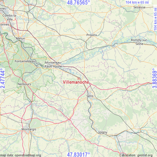
Villemanoche GPS coordinates[2]
48° 18' 0.18" North, 3° 10' 50.052" East
| Map corner | latitude | longitude |
|---|---|---|
| Upper-left | 48.76565°, | 2.47744° |
| Center: | 48.30005°, | 3.18057° |
| Lower-right: | 47.83017°, | 3.88369° |
| Map W x H: | 104×104 km | = 64.6×64.6mi |
| max Lat: | 51.07786° ⇑35.4% North |
| Villemanoche: | 48.30005° |
| min Lat: | ⇓64.6% South 41.3874° |
| min Long | Villemanoche | max Long |
| -5.08615° | 3.18057° | 9.52242° |
| W 60.3%⇐ | ⇒39.7% E |
Elevation
Elevation of Villemanoche is 68 m = 223 ft, and this is 125.7 m = 412 ft below average elevation for this country.
| Max E: |
2333 m = 7654 ft | 74.6% |
| Avg. | 193.7 m = 635 ft | |
| Villemanoche | 68 m = 223 ft | |
Min E: |
-1 m = -3 ft | 25.4% |
See also: France elevation on elevation.city.
Geographical zone
Villemanoche is located in North temperate zone (between Tropic of Cancer and the Arctic Circle). Distance of this North polar circle is 2030.7 km =1261.8 mi to North.| Distance of | km | miles | from Villemanoche |
|---|---|---|---|
| North Pole | 4636.6 | 2881 | to North |
| Arctic Circle | 2030.7 | 1261.8 | to North |
| Tropic Cancer | 2764.5 | 1717.8 | to South |
| Equator | 5370.5 | 3337.1 | to South |


Nearby cities:
15 places around Villemanoche: (largest is in red/bold)
• Brannay
9.1 km =5.7 mi,  211°
211°
• Champigny
4 km =2.5 mi,  297°
297°
• Chaumont
6 km =3.7 mi,  293°
293°
• Courlon-sur-Yonne
4.5 km =2.8 mi,  346°
346°
• Courtois-sur-Yonne
9.8 km =6.1 mi,  145°
145°
• Cuy
7.9 km =4.9 mi,  126°
126°
• Gisy-les-Nobles
5 km =3.1 mi,  113°
113°
• Michery
4 km =2.5 mi,  74°
74°
• Misy-sur-Yonne
9.5 km =5.9 mi,  315°
315°
• Pont-sur-Yonne
2.5 km =1.6 mi,  140°
140°
• Sergines
7.6 km =4.7 mi,  52°
52°
• Villeblevin
7.9 km =4.9 mi, 290°
• Villeneuve-la-Guyard
9.9 km =6.2 mi, 297°
• Villethierry
8.9 km =5.5 mi,  242°
242°
• Vinneuf
6.1 km =3.8 mi,  330°
330°
Sources, notices
• [Note1] Compared only with cities in France existing in our database
• [Src1] Map data: © OpenStreetMap contributors (CC-BY-SA)
• [Src2] Other city data from geonames.org with taken over terms of usage.
• [Src3] Geographical zone / Annual Mean Temperature by Robert A. Rohde @ Wikipedia
