Sergines geodata
Sergines (Bourgogne-Franche-Comté) is a populated place; located in France in Europe/Paris (GMT+2) time zone. With population of 1,121 people, there are 8006 cities with bigger population in this country. Compared to other cities in France, 65.3% of cities are located further ↓South; 61.5% of cities are located further ←West and 59.7% of cities have higher elevation than Sergines. Note1
Administrative division(s):
- Level 1: Bourgogne-Franche-Comté
- Level 2: Département de l'Yonne
- Level 3: Arrondissement de Sens
- Level 4: Sergines


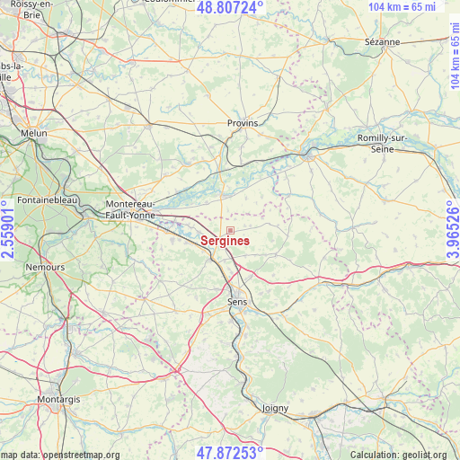
Sergines GPS coordinates[2]
48° 20' 31.308" North, 3° 15' 43.668" East
| Map corner | latitude | longitude |
|---|---|---|
| Upper-left | 48.80724°, | 2.55901° |
| Center: | 48.34203°, | 3.26213° |
| Lower-right: | 47.87253°, | 3.96526° |
| Map W x H: | 103.9×103.9 km | = 64.6×64.6mi |
| max Lat: | 51.07786° ⇑34.7% North |
| Sergines: | 48.34203° |
| min Lat: | ⇓65.3% South 41.3874° |
| min Long | Sergines | max Long |
| -5.08615° | 3.26213° | 9.52242° |
| W 61.5%⇐ | ⇒38.5% E |
Elevation
Elevation of Sergines is 103 m = 338 ft, and this is 90.7 m = 298 ft below average elevation for this country.
| Max E: |
2333 m = 7654 ft | 59.7% |
| Avg. | 193.7 m = 635 ft | |
| Sergines | 103 m = 338 ft | |
Min E: |
-1 m = -3 ft | 40.3% |
See also: France elevation on elevation.city.
Geographical zone
Sergines is located in North temperate zone (between Tropic of Cancer and the Arctic Circle). Distance of this North polar circle is 2026 km =1258.9 mi to North.| Distance of | km | miles | from Sergines |
|---|---|---|---|
| North Pole | 4631.9 | 2878.1 | to North |
| Arctic Circle | 2026 | 1258.9 | to North |
| Tropic Cancer | 2769.2 | 1720.7 | to South |
| Equator | 5375.1 | 3339.9 | to South |


Nearby cities:
15 places around Sergines: (largest is in red/bold)
• Bazoches-lès-Bray
8.3 km =5.2 mi,  319°
319°
• Bray-sur-Seine
8.2 km =5.1 mi,  347°
347°
• Champigny
9.9 km =6.2 mi,  253°
253°
• Chaumont
11.8 km =7.3 mi,  259°
259°
• Courlon-sur-Yonne
7.1 km =4.4 mi,  267°
267°
• Cuy
9.4 km =5.8 mi,  178°
178°
• Fontaine-Fourches
12.4 km =7.7 mi,  49°
49°
• Gisy-les-Nobles
6.8 km =4.2 mi,  192°
192°
• Michery
4.2 km =2.6 mi,  210°
210°
• Mousseaux-lès-Bray
8.5 km =5.3 mi,  342°
342°
• Pont-sur-Yonne
7.9 km =4.9 mi, 214°
• Soucy
11.2 km =7 mi,  156°
156°
• Thorigny-sur-Oreuse
11.6 km =7.2 mi,  117°
117°
• Villemanoche
7.6 km =4.7 mi,  232°
232°
• Vinneuf
9 km =5.6 mi, 274°
Sources, notices
• [Note1] Compared only with cities in France existing in our database
• [Src1] Map data: © OpenStreetMap contributors (CC-BY-SA)
• [Src2] Other city data from geonames.org with taken over terms of usage.
• [Src3] Geographical zone / Annual Mean Temperature by Robert A. Rohde @ Wikipedia
