Villedieu geodata
Villedieu (Auvergne-Rhône-Alpes) is a populated place; located in France in Europe/Paris (GMT+2) time zone. With population of 529 people, there are 14624 cities with bigger population in this country. Compared to other cities in France, 79.6% of cities are located further ↑North; 58.7% of cities are located further ←West and 98.7% of cities have lower elevation than Villedieu. Note1
Administrative division(s):
- Level 1: Auvergne-Rhône-Alpes
- Level 2: Cantal
- Level 3: Arrondissement de Saint-Flour
- Level 4: Villedieu


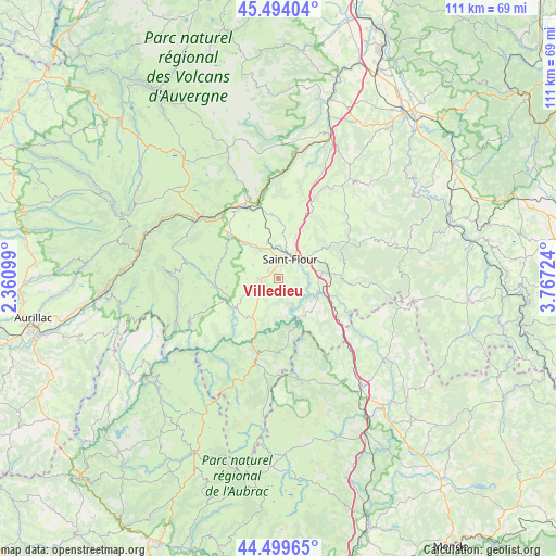
Villedieu GPS coordinates[2]
44° 59' 56.4" North, 3° 3' 50.796" East
| Map corner | latitude | longitude |
|---|---|---|
| Upper-left | 45.49404°, | 2.36099° |
| Center: | 44.999°, | 3.06411° |
| Lower-right: | 44.49965°, | 3.76724° |
| Map W x H: | 110.6×110.6 km | = 68.7×68.7mi |
| max Lat: | 51.07786° ⇑79.6% North |
| Villedieu: | 44.999° |
| min Lat: | ⇓20.4% South 41.3874° |
| min Long | Villedieu | max Long |
| -5.08615° | 3.06411° | 9.52242° |
| W 58.7%⇐ | ⇒41.3% E |
Elevation
Elevation of Villedieu is 914 m = 2999 ft, and this is 720.3 m = 2363 ft above average elevation for this country.
| Max E: |
2333 m = 7654 ft | 1.3% |
| Villedieu | 914 m 2999 ft | |
| Avg. | 193.7 m = 635 ft | |
Min E: |
-1 m = -3 ft | 98.7% |
See also: France elevation on elevation.city.
Geographical zone
Villedieu is located in North temperate zone (between Tropic of Cancer and the Arctic Circle). Distance of this Northern Tropic circle is 2397.5 km =1489.7 mi to South.| Distance of | km | miles | from Villedieu |
|---|---|---|---|
| North Pole | 5003.6 | 3109.1 | to North |
| Arctic Circle | 2397.8 | 1489.9 | to North |
| Tropic Cancer | 2397.5 | 1489.7 | to South |
| Equator | 5003.4 | 3109 | to South |


Nearby cities:
15 places around Villedieu: (largest is in red/bold)
• Allanche
27.5 km =17.1 mi,  338°
338°
• Chaudes-Aigues
16.7 km =10.4 mi,  196°
196°
• Laveissière
24 km =14.9 mi,  302°
302°
• Le Malzieu-Ville
26.4 km =16.4 mi,  126°
126°
• Massiac
30 km =18.6 mi,  20°
20°
• Murat
19.7 km =12.2 mi,  308°
308°
• Neussargues
15.9 km =9.9 mi,  334°
334°
• Neuvéglise
10.1 km =6.3 mi,  218°
218°
• Pierrefort
19.7 km =12.2 mi,  244°
244°
• Roffiac
6.3 km =3.9 mi, 340°
• Saint-Chély-d’Apcher
27.1 km =16.8 mi,  142°
142°
• Saint-Flour
4.5 km =2.8 mi,  30°
30°
• Talizat
12.9 km =8 mi,  353°
353°
• Thiézac
31.5 km =19.6 mi,  273°
273°
• Valuéjols
11.9 km =7.4 mi, 300°
Sources, notices
• [Note1] Compared only with cities in France existing in our database
• [Src1] Map data: © OpenStreetMap contributors (CC-BY-SA)
• [Src2] Other city data from geonames.org with taken over terms of usage.
• [Src3] Geographical zone / Annual Mean Temperature by Robert A. Rohde @ Wikipedia
