Pierrefort geodata
Pierrefort (Auvergne-Rhône-Alpes) is a populated place; located in France in Europe/Paris (GMT+2) time zone. With population of 1,014 people, there are 8739 cities with bigger population in this country. Compared to other cities in France, 80.3% of cities are located further ↑North; 55.5% of cities are located further ←West and 98.9% of cities have lower elevation than Pierrefort. Note1
Administrative division(s):
- Level 1: Auvergne-Rhône-Alpes
- Level 2: Cantal
- Level 3: Arrondissement de Saint-Flour
- Level 4: Pierrefort


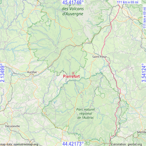
Pierrefort GPS coordinates[2]
44° 55' 18.3" North, 2° 50' 17.196" East
| Map corner | latitude | longitude |
|---|---|---|
| Upper-left | 45.41746°, | 2.13499° |
| Center: | 44.92175°, | 2.83811° |
| Lower-right: | 44.42173°, | 3.54124° |
| Map W x H: | 110.7×110.7 km | = 68.8×68.8mi |
| max Lat: | 51.07786° ⇑80.3% North |
| Pierrefort: | 44.92175° |
| min Lat: | ⇓19.7% South 41.3874° |
| min Long | Pierrefort | max Long |
| -5.08615° | 2.83811° | 9.52242° |
| W 55.5%⇐ | ⇒44.5% E |
Elevation
Elevation of Pierrefort is 940 m = 3084 ft, and this is 746.3 m = 2448 ft above average elevation for this country.
| Max E: |
2333 m = 7654 ft | 1.1% |
| Pierrefort | 940 m 3084 ft | |
| Avg. | 193.7 m = 635 ft | |
Min E: |
-1 m = -3 ft | 98.9% |
See also: France elevation on elevation.city.
Geographical zone
Pierrefort is located in North temperate zone (between Tropic of Cancer and the Arctic Circle). Distance of this Northern Tropic circle is 2388.9 km =1484.4 mi to South.| Distance of | km | miles | from Pierrefort |
|---|---|---|---|
| North Pole | 5012.2 | 3114.4 | to North |
| Arctic Circle | 2406.3 | 1495.2 | to North |
| Tropic Cancer | 2388.9 | 1484.4 | to South |
| Equator | 4994.8 | 3103.6 | to South |


Nearby cities:
15 places around Pierrefort: (largest is in red/bold)
• Brommat
15.9 km =9.9 mi,  229°
229°
• Chaudes-Aigues
15.1 km =9.4 mi,  119°
119°
• Lacroix-Barrez
22.3 km =13.9 mi, 225°
• Laveissière
21.8 km =13.5 mi,  353°
353°
• Mur-de-Barrez
16.4 km =10.2 mi,  238°
238°
• Murat
21.1 km =13.1 mi,  6°
6°
• Neuvéglise
11.5 km =7.1 mi,  86°
86°
• Polminhac
20.8 km =12.9 mi,  279°
279°
• Roffiac
21.4 km =13.3 mi,  47°
47°
• Sainte-Geneviève-sur-Argence
14.7 km =9.1 mi,  204°
204°
• Taussac
18.6 km =11.6 mi, 236°
• Thiézac
17.1 km =10.6 mi,  307°
307°
• Valuéjols
16.4 km =10.2 mi,  27°
27°
• Vic-sur-Cère
18 km =11.2 mi,  291°
291°
• Villedieu
19.7 km =12.2 mi,  64°
64°
Sources, notices
• [Note1] Compared only with cities in France existing in our database
• [Src1] Map data: © OpenStreetMap contributors (CC-BY-SA)
• [Src2] Other city data from geonames.org with taken over terms of usage.
• [Src3] Geographical zone / Annual Mean Temperature by Robert A. Rohde @ Wikipedia
