Verrières-le-Buisson geodata
Verrières-le-Buisson (Île-de-France) is a populated place; located in France in Europe/Paris (GMT+2) time zone. With population of 16,789 people, there are 565 cities with bigger population in this country. Compared to other cities in France, 74.2% of cities are located further ↓South; 53.3% of cities are located further →East and 67% of cities have higher elevation than Verrières-le-Buisson. Note1
Administrative division(s):
- Level 1: Île-de-France
- Level 2: Département de l'Essonne
- Level 3: Arrondissement de Palaiseau
- Level 4: Verrières-le-Buisson
Current local time in Verrières-le-Buisson:
01:16 AM, WednesdayDifference from your time zone: hours


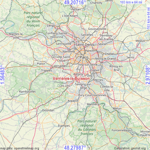
Verrières-le-Buisson GPS coordinates[2]
48° 44' 44.34" North, 2° 16' 4.656" East
| Map corner | latitude | longitude |
|---|---|---|
| Upper-left | 49.20716°, | 1.56483° |
| Center: | 48.74565°, | 2.26796° |
| Lower-right: | 48.27987°, | 2.97108° |
| Map W x H: | 103.1×103.1 km | = 64.1×64.1mi |
| max Lat: | 51.07786° ⇑25.8% North |
| Verrières-le-Buisson: | 48.74565° |
| min Lat: | ⇓74.2% South 41.3874° |
| min Long | Verrières-le-B | max Long |
| -5.08615° | 2.26796° | 9.52242° |
| W 46.7%⇐ | ⇒53.3% E |
Elevation
Elevation of Verrières-le-Buisson is 85 m = 279 ft, and this is 108.7 m = 357 ft below average elevation for this country.
| Max E: |
2333 m = 7654 ft | 67% |
| Avg. | 193.7 m = 635 ft | |
| Verrières-le-Buisson | 85 m = 279 ft | |
Min E: |
-1 m = -3 ft | 33% |
See also: France elevation on elevation.city.
Geographical zone
Verrières-le-Buisson is located in North temperate zone (between Tropic of Cancer and the Arctic Circle). Distance of this North polar circle is 1981.2 km =1231.1 mi to North.| Distance of | km | miles | from Verrières-le-Buisson |
|---|---|---|---|
| North Pole | 4587.1 | 2850.3 | to North |
| Arctic Circle | 1981.2 | 1231.1 | to North |
| Tropic Cancer | 2814.1 | 1748.6 | to South |
| Equator | 5420 | 3367.8 | to South |


Nearby cities:
15 places around Verrières-le-Buisson: (largest is in red/bold)
• Antony
2.3 km =1.4 mi,  68°
68°
• Bièvres
3.8 km =2.4 mi,  290°
290°
• Bourg-la-Reine
5.2 km =3.2 mi,  44°
44°
• Champlan
4.2 km =2.6 mi,  168°
168°
• Chilly-Mazarin
4.9 km =3 mi,  133°
133°
• Châtenay-Malabry
2.2 km =1.4 mi,  357°
357°
• Fresnes
4.1 km =2.5 mi, 74°
• Igny
3.2 km =2 mi,  267°
267°
• Le Plessis-Robinson
4.8 km =3 mi,  2°
2°
• Massy
2.4 km =1.5 mi,  152°
152°
• Palaiseau
3.3 km =2.1 mi,  203°
203°
• Sceaux
3.8 km =2.4 mi,  25°
25°
• Vauhallan
5 km =3.1 mi,  254°
254°
• Villebon-sur-Yvette
4.9 km =3 mi, 204°
• Wissous
4.3 km =2.7 mi,  108°
108°
Sources, notices
• [Note1] Compared only with cities in France existing in our database
• [Src1] Map data: © OpenStreetMap contributors (CC-BY-SA)
• [Src2] Other city data from geonames.org with taken over terms of usage.
• [Src3] Geographical zone / Annual Mean Temperature by Robert A. Rohde @ Wikipedia
