Vauhallan geodata
Vauhallan (Île-de-France) is a populated place; located in France in Europe/Paris (GMT+2) time zone. With population of 2,175 people, there are 4413 cities with bigger population in this country. Compared to other cities in France, 74% of cities are located further ↓South; 54.4% of cities are located further →East and 59.7% of cities have higher elevation than Vauhallan. Note1
Administrative division(s):
- Level 1: Île-de-France
- Level 2: Département de l'Essonne
- Level 3: Arrondissement de Palaiseau
- Level 4: Vauhallan


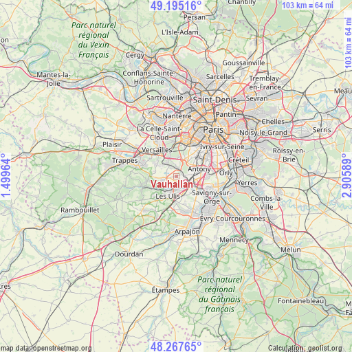
Vauhallan GPS coordinates[2]
48° 44' 0.744" North, 2° 12' 9.972" East
| Map corner | latitude | longitude |
|---|---|---|
| Upper-left | 49.19516°, | 1.49964° |
| Center: | 48.73354°, | 2.20277° |
| Lower-right: | 48.26765°, | 2.90589° |
| Map W x H: | 103.1×103.1 km | = 64.1×64.1mi |
| max Lat: | 51.07786° ⇑26% North |
| Vauhallan: | 48.73354° |
| min Lat: | ⇓74% South 41.3874° |
| min Long | Vauhallan | max Long |
| -5.08615° | 2.20277° | 9.52242° |
| W 45.6%⇐ | ⇒54.4% E |
Elevation
Elevation of Vauhallan is 103 m = 338 ft, and this is 90.7 m = 298 ft below average elevation for this country.
| Max E: |
2333 m = 7654 ft | 59.7% |
| Avg. | 193.7 m = 635 ft | |
| Vauhallan | 103 m = 338 ft | |
Min E: |
-1 m = -3 ft | 40.3% |
See also: France elevation on elevation.city.
Geographical zone
Vauhallan is located in North temperate zone (between Tropic of Cancer and the Arctic Circle). Distance of this North polar circle is 1982.5 km =1231.9 mi to North.| Distance of | km | miles | from Vauhallan |
|---|---|---|---|
| North Pole | 4588.4 | 2851.1 | to North |
| Arctic Circle | 1982.5 | 1231.9 | to North |
| Tropic Cancer | 2812.7 | 1747.7 | to South |
| Equator | 5418.7 | 3367 | to South |


Nearby cities:
15 places around Vauhallan: (largest is in red/bold)
• Bièvres
2.9 km =1.8 mi,  23°
23°
• Bures-sur-Yvette
4.4 km =2.7 mi,  212°
212°
• Châtenay-Malabry
5.8 km =3.6 mi,  53°
53°
• Igny
2 km =1.2 mi, 52°
• Jouy-en-Josas
3.7 km =2.3 mi,  319°
319°
• Les Loges-en-Josas
5.7 km =3.5 mi,  306°
306°
• Massy
5.9 km =3.7 mi,  97°
97°
• Orsay
4.4 km =2.7 mi,  195°
195°
• Palaiseau
3.8 km =2.4 mi,  116°
116°
• Saclay
2.5 km =1.6 mi,  267°
267°
• Saint-Aubin
5 km =3.1 mi,  243°
243°
• Verrières-le-Buisson
5 km =3.1 mi,  74°
74°
• Villebon-sur-Yvette
4.1 km =2.5 mi,  138°
138°
• Villejust
6.1 km =3.8 mi,  156°
156°
• Vélizy-Villacoublay
5.4 km =3.4 mi,  353°
353°
Sources, notices
• [Note1] Compared only with cities in France existing in our database
• [Src1] Map data: © OpenStreetMap contributors (CC-BY-SA)
• [Src2] Other city data from geonames.org with taken over terms of usage.
• [Src3] Geographical zone / Annual Mean Temperature by Robert A. Rohde @ Wikipedia
