Vendres geodata
Vendres (Occitanie) is a populated place; located in France in Europe/Paris (GMT+2) time zone. With population of 1,744 people, there are 5429 cities with bigger population in this country. Compared to other cities in France, 96.3% of cities are located further ↑North; 60.9% of cities are located further ←West and 96% of cities have higher elevation than Vendres. Note1
Administrative division(s):
- Level 1: Occitanie
- Level 2: Département de l'Hérault
- Level 3: Arrondissement de Béziers
- Level 4: Vendres


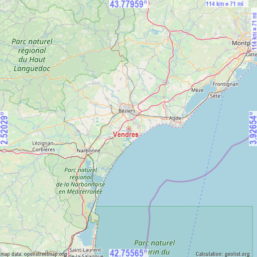
Vendres GPS coordinates[2]
43° 16' 11.172" North, 3° 13' 24.276" East
| Map corner | latitude | longitude |
|---|---|---|
| Upper-left | 43.77959°, | 2.52029° |
| Center: | 43.26977°, | 3.22341° |
| Lower-right: | 42.75565°, | 3.92654° |
| Map W x H: | 113.9×113.9 km | = 70.8×70.8mi |
| max Lat: | 51.07786° ⇑96.3% North |
| Vendres: | 43.26977° |
| min Lat: | ⇓3.7% South 41.3874° |
| min Long | Vendres | max Long |
| -5.08615° | 3.22341° | 9.52242° |
| W 60.9%⇐ | ⇒39.1% E |
Elevation
Elevation of Vendres is 14 m = 46 ft, and this is 179.7 m = 590 ft below average elevation for this country.
| Max E: |
2333 m = 7654 ft | 96% |
| Avg. | 193.7 m = 635 ft | |
| Vendres | 14 m = 46 ft | |
Min E: |
-1 m = -3 ft | 4% |
See also: France elevation on elevation.city.
Geographical zone
Vendres is located in North temperate zone (between Tropic of Cancer and the Arctic Circle). Distance of this Northern Tropic circle is 2205.2 km =1370.2 mi to South.| Distance of | km | miles | from Vendres |
|---|---|---|---|
| North Pole | 5195.9 | 3228.6 | to North |
| Arctic Circle | 2590 | 1609.4 | to North |
| Tropic Cancer | 2205.2 | 1370.2 | to South |
| Equator | 4811.1 | 2989.5 | to South |


Nearby cities:
15 places around Vendres: (largest is in red/bold)
• Boujan-sur-Libron
11.3 km =7 mi,  9°
9°
• Béziers
8 km =5 mi,  354°
354°
• Cers
8.9 km =5.5 mi,  47°
47°
• Colombiers
8.4 km =5.2 mi,  306°
306°
• Fleury
8.2 km =5.1 mi,  238°
238°
• Lespignan
4.2 km =2.6 mi,  275°
275°
• Maraussan
12.3 km =7.6 mi,  333°
333°
• Maureilhan
12.4 km =7.7 mi,  315°
315°
• Montady
10.7 km =6.6 mi, 313°
• Nissan-lez-Enserune
8.1 km =5 mi,  285°
285°
• Portiragnes
9.7 km =6 mi,  66°
66°
• Sauvian
3.9 km =2.4 mi, 49°
• Sérignan
4.5 km =2.8 mi,  77°
77°
• Valras-Plage
5.9 km =3.7 mi,  113°
113°
• Villeneuve-lès-Béziers
6.8 km =4.2 mi,  42°
42°
Sources, notices
• [Note1] Compared only with cities in France existing in our database
• [Src1] Map data: © OpenStreetMap contributors (CC-BY-SA)
• [Src2] Other city data from geonames.org with taken over terms of usage.
• [Src3] Geographical zone / Annual Mean Temperature by Robert A. Rohde @ Wikipedia
