Maureilhan geodata
Maureilhan (Occitanie) is a populated place; located in France in Europe/Paris (GMT+2) time zone. With population of 1,610 people, there are 5801 cities with bigger population in this country. Compared to other cities in France, 94.9% of cities are located further ↑North; 59.5% of cities are located further ←West and 81.5% of cities have higher elevation than Maureilhan. Note1
Administrative division(s):
- Level 1: Occitanie
- Level 2: Département de l'Hérault
- Level 3: Arrondissement de Béziers
- Level 4: Maureilhan


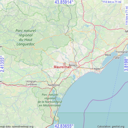
Maureilhan GPS coordinates[2]
43° 21' 0" North, 3° 7' 0.012" East
| Map corner | latitude | longitude |
|---|---|---|
| Upper-left | 43.85914°, | 2.41355° |
| Center: | 43.35°, | 3.11667° |
| Lower-right: | 42.83655°, | 3.8198° |
| Map W x H: | 113.7×113.7 km | = 70.6×70.6mi |
| max Lat: | 51.07786° ⇑94.9% North |
| Maureilhan: | 43.35° |
| min Lat: | ⇓5.1% South 41.3874° |
| min Long | Maureilhan | max Long |
| -5.08615° | 3.11667° | 9.52242° |
| W 59.5%⇐ | ⇒40.5% E |
Elevation
Elevation of Maureilhan is 51 m = 167 ft, and this is 142.7 m = 468 ft below average elevation for this country.
| Max E: |
2333 m = 7654 ft | 81.5% |
| Avg. | 193.7 m = 635 ft | |
| Maureilhan | 51 m = 167 ft | |
Min E: |
-1 m = -3 ft | 18.5% |
See also: France elevation on elevation.city.
Geographical zone
Maureilhan is located in North temperate zone (between Tropic of Cancer and the Arctic Circle). Distance of this Northern Tropic circle is 2214.1 km =1375.8 mi to South.| Distance of | km | miles | from Maureilhan |
|---|---|---|---|
| North Pole | 5187 | 3223.1 | to North |
| Arctic Circle | 2581.1 | 1603.8 | to North |
| Tropic Cancer | 2214.1 | 1375.8 | to South |
| Equator | 4820.1 | 2995.1 | to South |


Nearby cities:
15 places around Maureilhan: (largest is in red/bold)
• Béziers
7.9 km =4.9 mi,  97°
97°
• Capestang
6.3 km =3.9 mi,  247°
247°
• Cazouls-lès-Béziers
4.9 km =3 mi,  344°
344°
• Colombiers
4.4 km =2.7 mi,  155°
155°
• Corneilhan
8.2 km =5.1 mi,  47°
47°
• Creissan
8.9 km =5.5 mi,  288°
288°
• Lespignan
9.6 km =6 mi,  152°
152°
• Lignan-sur-Orb
5.7 km =3.5 mi, 47°
• Maraussan
3.8 km =2.4 mi,  56°
56°
• Montady
1.8 km =1.1 mi, 150°
• Murviel-lès-Béziers
9.4 km =5.8 mi,  8°
8°
• Nissan-lez-Enserune
6.8 km =4.2 mi,  172°
172°
• Pailhès
10.5 km =6.5 mi,  31°
31°
• Puisserguier
6.5 km =4 mi, 287°
• Thézan-lès-Béziers
8.4 km =5.2 mi, 28°
Sources, notices
• [Note1] Compared only with cities in France existing in our database
• [Src1] Map data: © OpenStreetMap contributors (CC-BY-SA)
• [Src2] Other city data from geonames.org with taken over terms of usage.
• [Src3] Geographical zone / Annual Mean Temperature by Robert A. Rohde @ Wikipedia
