Clion geodata
Clion (Centre) is a populated place; located in France in Europe/Paris (GMT+2) time zone. With population of 1,155 people, there are 7796 cities with bigger population in this country. Compared to other cities in France, 55.9% of cities are located further ↑North; 66.4% of cities are located further →East and 60% of cities have higher elevation than Clion. Note1
Administrative division(s):
- Level 1: Centre
- Level 2: Département de l'Indre
- Level 3: Arrondissement de Châteauroux
- Level 4: Clion


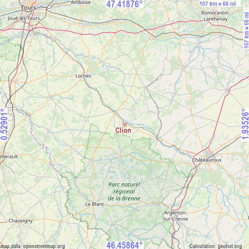
Clion GPS coordinates[2]
46° 56' 27.06" North, 1° 13' 55.704" East
| Map corner | latitude | longitude |
|---|---|---|
| Upper-left | 47.41876°, | 0.52901° |
| Center: | 46.94085°, | 1.23214° |
| Lower-right: | 46.45864°, | 1.93526° |
| Map W x H: | 106.8×106.8 km | = 66.4×66.4mi |
| max Lat: | 51.07786° ⇑55.9% North |
| Clion: | 46.94085° |
| min Lat: | ⇓44.1% South 41.3874° |
| min Long | Clion | max Long |
| -5.08615° | 1.23214° | 9.52242° |
| W 33.6%⇐ | ⇒66.4% E |
Elevation
Elevation of Clion is 102 m = 335 ft, and this is 91.7 m = 301 ft below average elevation for this country.
| Max E: |
2333 m = 7654 ft | 60% |
| Avg. | 193.7 m = 635 ft | |
| Clion | 102 m = 335 ft | |
Min E: |
-1 m = -3 ft | 40% |
See also: France elevation on elevation.city.
Geographical zone
Clion is located in North temperate zone (between Tropic of Cancer and the Arctic Circle). Distance of this North polar circle is 2181.8 km =1355.7 mi to North.| Distance of | km | miles | from Clion |
|---|---|---|---|
| North Pole | 4787.7 | 2974.9 | to North |
| Arctic Circle | 2181.8 | 1355.7 | to North |
| Tropic Cancer | 2613.4 | 1623.9 | to South |
| Equator | 5219.3 | 3243.1 | to South |


Nearby cities:
15 places around Clion: (largest is in red/bold)
• Argy
15.6 km =9.7 mi,  90°
90°
• Azay-le-Ferron
15.8 km =9.8 mi,  230°
230°
• Bridoré
14.9 km =9.3 mi,  310°
310°
• Buzançais
15.4 km =9.6 mi,  112°
112°
• Châtillon-sur-Indre
6.9 km =4.3 mi,  318°
318°
• Fléré-la-Rivière
12.9 km =8 mi, 313°
• Loché-sur-Indrois
16.8 km =10.4 mi,  356°
356°
• Mézières-en-Brenne
13.6 km =8.5 mi,  186°
186°
• Palluau-sur-Indre
6.1 km =3.8 mi, 88°
• Pellevoisin
14.8 km =9.2 mi,  71°
71°
• Saint-Flovier
15.9 km =9.9 mi,  281°
281°
• Saint-Genou
8 km =5 mi,  99°
99°
• Saint-Hippolyte
16.5 km =10.3 mi, 322°
• Vendœuvres
18 km =11.2 mi,  150°
150°
• Écueillé
18.2 km =11.3 mi,  28°
28°
Sources, notices
• [Note1] Compared only with cities in France existing in our database
• [Src1] Map data: © OpenStreetMap contributors (CC-BY-SA)
• [Src2] Other city data from geonames.org with taken over terms of usage.
• [Src3] Geographical zone / Annual Mean Temperature by Robert A. Rohde @ Wikipedia
