Uchacq-et-Parentis geodata
Uchacq-et-Parentis (Nouvelle-Aquitaine) is a populated place; located in France in Europe/Paris (GMT+2) time zone. With population of 548 people, there are 14246 cities with bigger population in this country. Compared to other cities in France, 87.8% of cities are located further ↑North; 84.1% of cities are located further →East and 79.8% of cities have higher elevation than Uchacq-et-Parentis. Note1
Administrative division(s):
- Level 1: Nouvelle-Aquitaine
- Level 2: Landes
- Level 3: Arrondissement de Mont-de-Marsan
- Level 4: Uchacq-et-Parentis


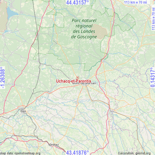
Uchacq-et-Parentis GPS coordinates[2]
43° 55' 38.352" North, 0° 33' 35.856" West
| Map corner | latitude | longitude |
|---|---|---|
| Upper-left | 44.43157°, | -1.26308° |
| Center: | 43.92732°, | -0.55996° |
| Lower-right: | 43.41876°, | 0.14317° |
| Map W x H: | 112.6×112.6 km | = 70×70mi |
| max Lat: | 51.07786° ⇑87.8% North |
| Uchacq-et-Parentis: | 43.92732° |
| min Lat: | ⇓12.2% South 41.3874° |
| min Long | Uchacq-et-Paren | max Long |
| -5.08615° | -0.55996° | 9.52242° |
| W 15.9%⇐ | ⇒84.1% E |
Elevation
Elevation of Uchacq-et-Parentis is 55 m = 180 ft, and this is 138.7 m = 455 ft below average elevation for this country.
| Max E: |
2333 m = 7654 ft | 79.8% |
| Avg. | 193.7 m = 635 ft | |
| Uchacq-et-Parentis | 55 m = 180 ft | |
Min E: |
-1 m = -3 ft | 20.2% |
See also: France elevation on elevation.city.
Geographical zone
Uchacq-et-Parentis is located in North temperate zone (between Tropic of Cancer and the Arctic Circle). Distance of this Northern Tropic circle is 2278.3 km =1415.7 mi to South.| Distance of | km | miles | from Uchacq-et-Parentis |
|---|---|---|---|
| North Pole | 5122.8 | 3183.2 | to North |
| Arctic Circle | 2516.9 | 1563.9 | to North |
| Tropic Cancer | 2278.3 | 1415.7 | to South |
| Equator | 4884.3 | 3035 | to South |


Nearby cities:
15 places around Uchacq-et-Parentis: (largest is in red/bold)
• Aurice
13 km =8.1 mi,  195°
195°
• Benquet
11.8 km =7.3 mi,  156°
156°
• Bougue
14.1 km =8.8 mi,  107°
107°
• Bretagne-de-Marsan
11.7 km =7.3 mi,  139°
139°
• Brocas
13.2 km =8.2 mi,  9°
9°
• Campagne
9.4 km =5.8 mi,  222°
222°
• Geloux
8.7 km =5.4 mi,  313°
313°
• Haut-Mauco
11.2 km =7 mi,  178°
178°
• Laglorieuse
14 km =8.7 mi,  117°
117°
• Meilhan
13.6 km =8.5 mi,  239°
239°
• Mont-de-Marsan
6.5 km =4 mi,  129°
129°
• Saint-Avit
9.2 km =5.7 mi,  80°
80°
• Saint-Perdon
7.3 km =4.5 mi, 199°
• Saint-Pierre-du-Mont
5.7 km =3.5 mi,  147°
147°
• Ygos-Saint-Saturnin
15.3 km =9.5 mi,  291°
291°
Sources, notices
• [Note1] Compared only with cities in France existing in our database
• [Src1] Map data: © OpenStreetMap contributors (CC-BY-SA)
• [Src2] Other city data from geonames.org with taken over terms of usage.
• [Src3] Geographical zone / Annual Mean Temperature by Robert A. Rohde @ Wikipedia
