Haut-Mauco geodata
Haut-Mauco (Nouvelle-Aquitaine) is a populated place; located in France in Europe/Paris (GMT+2) time zone. With population of 803 people, there are 10571 cities with bigger population in this country. Compared to other cities in France, 88.9% of cities are located further ↑North; 84% of cities are located further →East and 67.4% of cities have higher elevation than Haut-Mauco. Note1
Administrative division(s):
- Level 1: Nouvelle-Aquitaine
- Level 2: Landes
- Level 3: Arrondissement de Mont-de-Marsan
- Level 4: Haut-Mauco


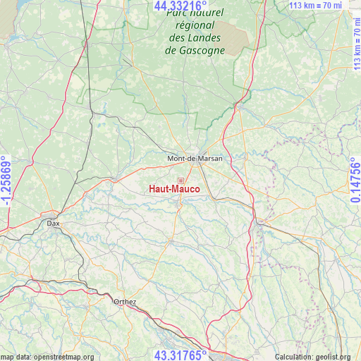
Haut-Mauco GPS coordinates[2]
43° 49' 37.416" North, 0° 33' 20.052" West
| Map corner | latitude | longitude |
|---|---|---|
| Upper-left | 44.33216°, | -1.25869° |
| Center: | 43.82706°, | -0.55557° |
| Lower-right: | 43.31765°, | 0.14756° |
| Map W x H: | 112.8×112.8 km | = 70.1×70.1mi |
| max Lat: | 51.07786° ⇑88.9% North |
| Haut-Mauco: | 43.82706° |
| min Lat: | ⇓11.1% South 41.3874° |
| min Long | Haut-Mauco | max Long |
| -5.08615° | -0.55557° | 9.52242° |
| W 16%⇐ | ⇒84% E |
Elevation
Elevation of Haut-Mauco is 84 m = 276 ft, and this is 109.7 m = 360 ft below average elevation for this country.
| Max E: |
2333 m = 7654 ft | 67.4% |
| Avg. | 193.7 m = 635 ft | |
| Haut-Mauco | 84 m = 276 ft | |
Min E: |
-1 m = -3 ft | 32.6% |
See also: France elevation on elevation.city.
Geographical zone
Haut-Mauco is located in North temperate zone (between Tropic of Cancer and the Arctic Circle). Distance of this Northern Tropic circle is 2267.2 km =1408.8 mi to South.| Distance of | km | miles | from Haut-Mauco |
|---|---|---|---|
| North Pole | 5133.9 | 3190.1 | to North |
| Arctic Circle | 2528.1 | 1570.9 | to North |
| Tropic Cancer | 2267.2 | 1408.8 | to South |
| Equator | 4873.1 | 3028 | to South |


Nearby cities:
15 places around Haut-Mauco: (largest is in red/bold)
• Aurice
4.2 km =2.6 mi,  250°
250°
• Bascons
11.1 km =6.9 mi,  92°
92°
• Benquet
4.4 km =2.7 mi, 85°
• Bretagne-de-Marsan
7.6 km =4.7 mi,  72°
72°
• Campagne
7.9 km =4.9 mi,  302°
302°
• Grenade-sur-l’Adour
11.5 km =7.1 mi,  118°
118°
• Mont-de-Marsan
8.4 km =5.2 mi,  33°
33°
• Montaut
12.5 km =7.8 mi,  219°
219°
• Montgaillard
11 km =6.8 mi,  148°
148°
• Montsoué
11.2 km =7 mi,  159°
159°
• Saint-Maurice-sur-Adour
8.5 km =5.3 mi, 123°
• Saint-Perdon
5.1 km =3.2 mi,  326°
326°
• Saint-Pierre-du-Mont
6.9 km =4.3 mi,  22°
22°
• Saint-Sever
7.9 km =4.9 mi,  190°
190°
• Uchacq-et-Parentis
11.2 km =7 mi,  358°
358°
Sources, notices
• [Note1] Compared only with cities in France existing in our database
• [Src1] Map data: © OpenStreetMap contributors (CC-BY-SA)
• [Src2] Other city data from geonames.org with taken over terms of usage.
• [Src3] Geographical zone / Annual Mean Temperature by Robert A. Rohde @ Wikipedia
