Saint-Barnabé geodata
Saint-Barnabé (Brittany) is a populated place; located in France in Europe/Paris (GMT+2) time zone. With population of 1,414 people, there are 6543 cities with bigger population in this country. Compared to other cities in France, 61.8% of cities are located further ↓South; 96.7% of cities are located further →East and 53.1% of cities have lower elevation than Saint-Barnabé. Note1
Administrative division(s):
- Level 1: Brittany
- Level 2: Département des Côtes-d’Armor
- Level 3: Arrondissement de Saint-Brieuc
- Level 4: Saint-Barnabé


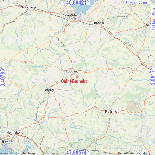
Saint-Barnabé GPS coordinates[2]
48° 8' 13.632" North, 2° 42' 17.388" West
| Map corner | latitude | longitude |
|---|---|---|
| Upper-left | 48.60421°, | -3.40795° |
| Center: | 48.13712°, | -2.70483° |
| Lower-right: | 47.66574°, | -2.0017° |
| Map W x H: | 104.3×104.3 km | = 64.8×64.8mi |
| max Lat: | 51.07786° ⇑38.2% North |
| Saint-Barnabé: | 48.13712° |
| min Lat: | ⇓61.8% South 41.3874° |
| min Long | Saint-Barnabé | max Long |
| -5.08615° | -2.70483° | 9.52242° |
| W 3.3%⇐ | ⇒96.7% E |
Elevation
Elevation of Saint-Barnabé is 143 m = 469 ft, and this is 50.7 m = 166 ft below average elevation for this country.
| Max E: |
2333 m = 7654 ft | 46.9% |
| Avg. | 193.7 m = 635 ft | |
| Saint-Barnabé | 143 m = 469 ft | |
Min E: |
-1 m = -3 ft | 53.1% |
See also: France elevation on elevation.city.
Geographical zone
Saint-Barnabé is located in North temperate zone (between Tropic of Cancer and the Arctic Circle). Distance of this North polar circle is 2048.8 km =1273.1 mi to North.| Distance of | km | miles | from Saint-Barnabé |
|---|---|---|---|
| North Pole | 4654.7 | 2892.3 | to North |
| Arctic Circle | 2048.8 | 1273.1 | to North |
| Tropic Cancer | 2746.4 | 1706.5 | to South |
| Equator | 5352.3 | 3325.8 | to South |


Nearby cities:
15 places around Saint-Barnabé: (largest is in red/bold)
• Crédin
12.3 km =7.6 mi,  201°
201°
• Gueltas
8.2 km =5.1 mi,  235°
235°
• Hémonstoir
9.6 km =6 mi,  284°
284°
• La Chèze
3.7 km =2.3 mi,  101°
101°
• La Motte
10.9 km =6.8 mi,  349°
349°
• La Prénessaye
7.2 km =4.5 mi,  45°
45°
• La Trinité-Porhoët
12.8 km =8 mi,  110°
110°
• Le Cambout
11.2 km =7 mi,  141°
141°
• Loudéac
5.9 km =3.7 mi,  321°
321°
• Plumieux
9.7 km =6 mi, 112°
• Plémet
9.3 km =5.8 mi,  62°
62°
• Rohan
8.4 km =5.2 mi, 204°
• Saint-Caradec
12.1 km =7.5 mi,  301°
301°
• Saint-Gonnery
8.5 km =5.3 mi,  260°
260°
• Trévé
10.5 km =6.5 mi, 321°
Sources, notices
• [Note1] Compared only with cities in France existing in our database
• [Src1] Map data: © OpenStreetMap contributors (CC-BY-SA)
• [Src2] Other city data from geonames.org with taken over terms of usage.
• [Src3] Geographical zone / Annual Mean Temperature by Robert A. Rohde @ Wikipedia
