Langast geodata
Langast (Brittany) is a populated place; located in France in Europe/Paris (GMT+2) time zone. With population of 672 people, there are 12186 cities with bigger population in this country. Compared to other cities in France, 64.2% of cities are located further ↓South; 96.6% of cities are located further →East and 58.4% of cities have lower elevation than Langast. Note1
Administrative division(s):
- Level 1: Brittany
- Level 2: Département des Côtes-d’Armor
- Level 3: Arrondissement de Saint-Brieuc
- Level 4: Plouguenast-Langast


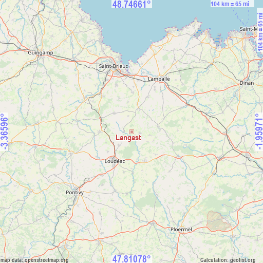
Langast GPS coordinates[2]
48° 16' 51.024" North, 2° 39' 46.224" West
| Map corner | latitude | longitude |
|---|---|---|
| Upper-left | 48.74661°, | -3.36596° |
| Center: | 48.28084°, | -2.66284° |
| Lower-right: | 47.81078°, | -1.95971° |
| Map W x H: | 104.1×104.1 km | = 64.7×64.7mi |
| max Lat: | 51.07786° ⇑35.8% North |
| Langast: | 48.28084° |
| min Lat: | ⇓64.2% South 41.3874° |
| min Long | Langast | max Long |
| -5.08615° | -2.66284° | 9.52242° |
| W 3.4%⇐ | ⇒96.6% E |
Elevation
Elevation of Langast is 163 m = 535 ft, and this is 30.7 m = 101 ft below average elevation for this country.
| Max E: |
2333 m = 7654 ft | 41.6% |
| Avg. | 193.7 m = 635 ft | |
| Langast | 163 m = 535 ft | |
Min E: |
-1 m = -3 ft | 58.4% |
See also: France elevation on elevation.city.
Geographical zone
Langast is located in North temperate zone (between Tropic of Cancer and the Arctic Circle). Distance of this North polar circle is 2032.8 km =1263.1 mi to North.| Distance of | km | miles | from Langast |
|---|---|---|---|
| North Pole | 4638.7 | 2882.4 | to North |
| Arctic Circle | 2032.8 | 1263.1 | to North |
| Tropic Cancer | 2762.4 | 1716.5 | to South |
| Equator | 5368.3 | 3335.7 | to South |


Nearby cities:
15 places around Langast: (largest is in red/bold)
• Collinée
10.9 km =6.8 mi,  79°
79°
• Gausson
7 km =4.3 mi,  286°
286°
• Hénon
11.6 km =7.2 mi,  352°
352°
• La Motte
7.4 km =4.6 mi,  224°
224°
• La Prénessaye
11.1 km =6.9 mi,  169°
169°
• Moncontour
9.1 km =5.7 mi,  14°
14°
• Plessala
3.3 km =2.1 mi,  98°
98°
• Plouguenast
3.1 km =1.9 mi,  272°
272°
• Plémet
12.7 km =7.9 mi,  156°
156°
• Plémy
6.3 km =3.9 mi, 346°
• Plœuc-sur-Lié
10 km =6.2 mi,  320°
320°
• Saint-Gouéno
7.2 km =4.5 mi, 101°
• Trébry
11.7 km =7.3 mi,  45°
45°
• Trédaniel
9.2 km =5.7 mi,  20°
20°
• Trévé
12.4 km =7.7 mi,  231°
231°
Sources, notices
• [Note1] Compared only with cities in France existing in our database
• [Src1] Map data: © OpenStreetMap contributors (CC-BY-SA)
• [Src2] Other city data from geonames.org with taken over terms of usage.
• [Src3] Geographical zone / Annual Mean Temperature by Robert A. Rohde @ Wikipedia
