Thourie geodata
Thourie (Brittany) is a populated place; located in France in Europe/Paris (GMT+2) time zone. With population of 578 people, there are 13683 cities with bigger population in this country. Compared to other cities in France, 56.7% of cities are located further ↓South; 92.1% of cities are located further →East and 77.3% of cities have higher elevation than Thourie. Note1
Administrative division(s):
- Level 1: Brittany
- Level 2: Département d'Ille-et-Vilaine
- Level 3: Arrondissement de Fougères-Vitré
- Level 4: Thourie


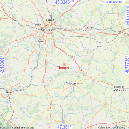
Thourie GPS coordinates[2]
47° 51' 17.82" North, 1° 28' 49.728" West
| Map corner | latitude | longitude |
|---|---|---|
| Upper-left | 48.32461°, | -2.18361° |
| Center: | 47.85495°, | -1.48048° |
| Lower-right: | 47.381°, | -0.77736° |
| Map W x H: | 104.9×104.9 km | = 65.2×65.2mi |
| max Lat: | 51.07786° ⇑43.3% North |
| Thourie: | 47.85495° |
| min Lat: | ⇓56.7% South 41.3874° |
| min Long | Thourie | max Long |
| -5.08615° | -1.48048° | 9.52242° |
| W 7.9%⇐ | ⇒92.1% E |
Elevation
Elevation of Thourie is 61 m = 200 ft, and this is 132.7 m = 435 ft below average elevation for this country.
| Max E: |
2333 m = 7654 ft | 77.3% |
| Avg. | 193.7 m = 635 ft | |
| Thourie | 61 m = 200 ft | |
Min E: |
-1 m = -3 ft | 22.7% |
See also: France elevation on elevation.city.
Geographical zone
Thourie is located in North temperate zone (between Tropic of Cancer and the Arctic Circle). Distance of this North polar circle is 2080.2 km =1292.6 mi to North.| Distance of | km | miles | from Thourie |
|---|---|---|---|
| North Pole | 4686.1 | 2911.8 | to North |
| Arctic Circle | 2080.2 | 1292.6 | to North |
| Tropic Cancer | 2715.1 | 1687.1 | to South |
| Equator | 5321 | 3306.3 | to South |


Nearby cities:
15 places around Thourie: (largest is in red/bold)
• Brie
11.5 km =7.1 mi,  338°
338°
• Coësmes
4.3 km =2.7 mi,  43°
43°
• Ercé-en-Lamée
6.4 km =4 mi,  245°
245°
• Essé
12.1 km =7.5 mi,  20°
20°
• Fercé
8.2 km =5.1 mi,  144°
144°
• Janzé
11.7 km =7.3 mi,  353°
353°
• Lalleu
2.3 km =1.4 mi,  271°
271°
• Le Sel-de-Bretagne
11.3 km =7 mi,  296°
296°
• Le Theil-de-Bretagne
8.1 km =5 mi,  27°
27°
• Retiers
10 km =6.2 mi,  48°
48°
• Rougé
8.3 km =5.2 mi,  162°
162°
• Ruffigné
10.9 km =6.8 mi,  185°
185°
• Saulnières
10.3 km =6.4 mi,  310°
310°
• Teillay
6.8 km =4.2 mi,  220°
220°
• Tresbœuf
6.1 km =3.8 mi, 301°
Sources, notices
• [Note1] Compared only with cities in France existing in our database
• [Src1] Map data: © OpenStreetMap contributors (CC-BY-SA)
• [Src2] Other city data from geonames.org with taken over terms of usage.
• [Src3] Geographical zone / Annual Mean Temperature by Robert A. Rohde @ Wikipedia
