Lalleu geodata
Lalleu (Brittany) is a populated place; located in France in Europe/Paris (GMT+2) time zone. With population of 511 people, there are 15016 cities with bigger population in this country. Compared to other cities in France, 56.7% of cities are located further ↓South; 92.3% of cities are located further →East and 78.6% of cities have higher elevation than Lalleu. Note1
Administrative division(s):
- Level 1: Brittany
- Level 2: Département d'Ille-et-Vilaine
- Level 3: Arrondissement de Redon
- Level 4: Lalleu


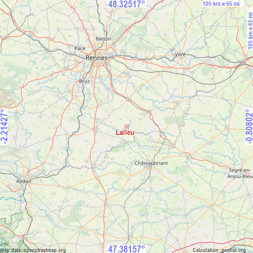
Lalleu GPS coordinates[2]
47° 51' 19.872" North, 1° 30' 40.14" West
| Map corner | latitude | longitude |
|---|---|---|
| Upper-left | 48.32517°, | -2.21427° |
| Center: | 47.85552°, | -1.51115° |
| Lower-right: | 47.38157°, | -0.80802° |
| Map W x H: | 104.9×104.9 km | = 65.2×65.2mi |
| max Lat: | 51.07786° ⇑43.3% North |
| Lalleu: | 47.85552° |
| min Lat: | ⇓56.7% South 41.3874° |
| min Long | Lalleu | max Long |
| -5.08615° | -1.51115° | 9.52242° |
| W 7.7%⇐ | ⇒92.3% E |
Elevation
Elevation of Lalleu is 58 m = 190 ft, and this is 135.7 m = 445 ft below average elevation for this country.
| Max E: |
2333 m = 7654 ft | 78.6% |
| Avg. | 193.7 m = 635 ft | |
| Lalleu | 58 m = 190 ft | |
Min E: |
-1 m = -3 ft | 21.4% |
See also: France elevation on elevation.city.
Geographical zone
Lalleu is located in North temperate zone (between Tropic of Cancer and the Arctic Circle). Distance of this North polar circle is 2080.1 km =1292.5 mi to North.| Distance of | km | miles | from Lalleu |
|---|---|---|---|
| North Pole | 4686 | 2911.7 | to North |
| Arctic Circle | 2080.1 | 1292.5 | to North |
| Tropic Cancer | 2715.1 | 1687.1 | to South |
| Equator | 5321 | 3306.3 | to South |


Nearby cities:
15 places around Lalleu: (largest is in red/bold)
• Brie
10.8 km =6.7 mi,  349°
349°
• Coësmes
6.1 km =3.8 mi,  59°
59°
• Ercé-en-Lamée
4.5 km =2.8 mi,  231°
231°
• Fercé
9.7 km =6 mi,  133°
133°
• Janzé
11.6 km =7.2 mi,  4°
4°
• Le Petit-Fougeray
10.8 km =6.7 mi,  318°
318°
• Le Sel-de-Bretagne
9.3 km =5.8 mi,  302°
302°
• Le Theil-de-Bretagne
9.4 km =5.8 mi,  40°
40°
• Pancé
11.4 km =7.1 mi,  284°
284°
• Rougé
9.3 km =5.8 mi,  149°
149°
• Ruffigné
11 km =6.8 mi,  173°
173°
• Saulnières
8.7 km =5.4 mi, 320°
• Teillay
5.7 km =3.5 mi,  201°
201°
• Thourie
2.3 km =1.4 mi,  91°
91°
• Tresbœuf
4.2 km =2.6 mi, 316°
Sources, notices
• [Note1] Compared only with cities in France existing in our database
• [Src1] Map data: © OpenStreetMap contributors (CC-BY-SA)
• [Src2] Other city data from geonames.org with taken over terms of usage.
• [Src3] Geographical zone / Annual Mean Temperature by Robert A. Rohde @ Wikipedia
