Ruffigné geodata
Ruffigné (Pays de la Loire) is a populated place; located in France in Europe/Paris (GMT+2) time zone. With population of 649 people, there are 12531 cities with bigger population in this country. Compared to other cities in France, 55.1% of cities are located further ↓South; 92.2% of cities are located further →East and 67% of cities have higher elevation than Ruffigné. Note1
Administrative division(s):
- Level 1: Pays de la Loire
- Level 2: Loire-Atlantique
- Level 3: Arrondissement of Châteaubriant-Ancenis
- Level 4: Ruffigné


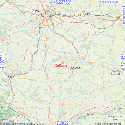
Ruffigné GPS coordinates[2]
47° 45' 25.344" North, 1° 29' 40.452" West
| Map corner | latitude | longitude |
|---|---|---|
| Upper-left | 48.22759°, | -2.1977° |
| Center: | 47.75704°, | -1.49457° |
| Lower-right: | 47.2822°, | -0.79145° |
| Map W x H: | 105.1×105.1 km | = 65.3×65.3mi |
| max Lat: | 51.07786° ⇑44.9% North |
| Ruffigné: | 47.75704° |
| min Lat: | ⇓55.1% South 41.3874° |
| min Long | Ruffigné | max Long |
| -5.08615° | -1.49457° | 9.52242° |
| W 7.8%⇐ | ⇒92.2% E |
Elevation
Elevation of Ruffigné is 85 m = 279 ft, and this is 108.7 m = 357 ft below average elevation for this country.
| Max E: |
2333 m = 7654 ft | 67% |
| Avg. | 193.7 m = 635 ft | |
| Ruffigné | 85 m = 279 ft | |
Min E: |
-1 m = -3 ft | 33% |
See also: France elevation on elevation.city.
Geographical zone
Ruffigné is located in North temperate zone (between Tropic of Cancer and the Arctic Circle). Distance of this North polar circle is 2091.1 km =1299.3 mi to North.| Distance of | km | miles | from Ruffigné |
|---|---|---|---|
| North Pole | 4697 | 2918.6 | to North |
| Arctic Circle | 2091.1 | 1299.3 | to North |
| Tropic Cancer | 2704.2 | 1680.3 | to South |
| Equator | 5310.1 | 3299.5 | to South |


Nearby cities:
15 places around Ruffigné: (largest is in red/bold)
• Châteaubriant
9.9 km =6.2 mi,  116°
116°
• Ercé-en-Lamée
9.5 km =5.9 mi,  329°
329°
• Fercé
7.2 km =4.5 mi,  53°
53°
• La Dominelais
14.5 km =9 mi,  272°
272°
• Lalleu
11 km =6.8 mi,  353°
353°
• Louisfert
10.2 km =6.3 mi,  153°
153°
• Lusanger
11 km =6.8 mi,  219°
219°
• Noyal-sur-Brutz
11.2 km =7 mi,  79°
79°
• Rougé
4.6 km =2.9 mi, 49°
• Saint-Aubin-des-Châteaux
4.1 km =2.5 mi,  173°
173°
• Saint-Vincent-des-Landes
11.1 km =6.9 mi,  180°
180°
• Sion-les-Mines
7.7 km =4.8 mi,  251°
251°
• Soudan
14.3 km =8.9 mi,  98°
98°
• Teillay
6.6 km =4.1 mi, 329°
• Thourie
10.9 km =6.8 mi,  5°
5°
Sources, notices
• [Note1] Compared only with cities in France existing in our database
• [Src1] Map data: © OpenStreetMap contributors (CC-BY-SA)
• [Src2] Other city data from geonames.org with taken over terms of usage.
• [Src3] Geographical zone / Annual Mean Temperature by Robert A. Rohde @ Wikipedia
