Thorée-les-Pins geodata
Thorée-les-Pins (Pays de la Loire) is a populated place; located in France in Europe/Paris (GMT+2) time zone. With population of 701 people, there are 11792 cities with bigger population in this country. Compared to other cities in France, 54% of cities are located further ↓South; 77.8% of cities are located further →East and 83.4% of cities have higher elevation than Thorée-les-Pins. Note1
Administrative division(s):
- Level 1: Pays de la Loire
- Level 2: Sarthe
- Level 3: Arrondissement de La Flèche
- Level 4: Thorée-les-Pins


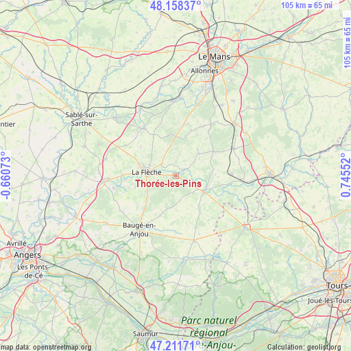
Thorée-les-Pins GPS coordinates[2]
47° 41' 13.884" North, 0° 2' 32.604" East
| Map corner | latitude | longitude |
|---|---|---|
| Upper-left | 48.15837°, | -0.66073° |
| Center: | 47.68719°, | 0.04239° |
| Lower-right: | 47.21171°, | 0.74552° |
| Map W x H: | 105.3×105.3 km | = 65.4×65.4mi |
| max Lat: | 51.07786° ⇑46% North |
| Thorée-les-Pins: | 47.68719° |
| min Lat: | ⇓54% South 41.3874° |
| min Long | Thorée-les-Pin | max Long |
| -5.08615° | 0.04239° | 9.52242° |
| W 22.2%⇐ | ⇒77.8% E |
Elevation
Elevation of Thorée-les-Pins is 46 m = 151 ft, and this is 147.7 m = 485 ft below average elevation for this country.
| Max E: |
2333 m = 7654 ft | 83.4% |
| Avg. | 193.7 m = 635 ft | |
| Thorée-les-Pins | 46 m = 151 ft | |
Min E: |
-1 m = -3 ft | 16.6% |
See also: France elevation on elevation.city.
Geographical zone
Thorée-les-Pins is located in North temperate zone (between Tropic of Cancer and the Arctic Circle). Distance of this North polar circle is 2098.9 km =1304.2 mi to North.| Distance of | km | miles | from Thorée-les-Pins |
|---|---|---|---|
| North Pole | 4704.7 | 2923.4 | to North |
| Arctic Circle | 2098.9 | 1304.2 | to North |
| Tropic Cancer | 2696.4 | 1675.5 | to South |
| Equator | 5302.3 | 3294.7 | to South |


Nearby cities:
15 places around Thorée-les-Pins: (largest is in red/bold)
• Clefs-Val d'Anjou
10.9 km =6.8 mi,  230°
230°
• Clermont-Créans
5.5 km =3.4 mi,  309°
309°
• Coulongé
11.9 km =7.4 mi,  88°
88°
• Cré-sur-Loir
15.1 km =9.4 mi,  265°
265°
• Dissé-sous-le-Lude
12 km =7.5 mi,  135°
135°
• La Flèche
8.9 km =5.5 mi,  277°
277°
• Le Lude
9.7 km =6 mi,  117°
117°
• Luché-Pringé
3.1 km =1.9 mi,  54°
54°
• Mansigné
9.6 km =6 mi,  44°
44°
• Mareil-sur-Loir
3.8 km =2.4 mi,  321°
321°
• Oizé
14.4 km =8.9 mi,  18°
18°
• Pontvallain
13.3 km =8.3 mi,  57°
57°
• Requeil
13.9 km =8.6 mi, 39°
• Saint-Jean-de-la-Motte
6.4 km =4 mi,  9°
9°
• Villaines-sous-Malicorne
13.5 km =8.4 mi, 308°
Sources, notices
• [Note1] Compared only with cities in France existing in our database
• [Src1] Map data: © OpenStreetMap contributors (CC-BY-SA)
• [Src2] Other city data from geonames.org with taken over terms of usage.
• [Src3] Geographical zone / Annual Mean Temperature by Robert A. Rohde @ Wikipedia
