Thiembronne geodata
Thiembronne (Hauts-de-France) is a populated place; located in France in Europe/Paris (GMT+2) time zone. With population of 635 people, there are 12740 cities with bigger population in this country. Compared to other cities in France, 98.3% of cities are located further ↓South; 56.3% of cities are located further →East and 60% of cities have higher elevation than Thiembronne. Note1
Administrative division(s):
- Level 1: Hauts-de-France
- Level 2: Pas-de-Calais
- Level 3: Arrondissement de Saint-Omer
- Level 4: Thiembronne


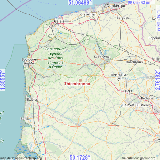
Thiembronne GPS coordinates[2]
50° 37' 15.636" North, 2° 3' 31.284" East
| Map corner | latitude | longitude |
|---|---|---|
| Upper-left | 51.06499°, | 1.35557° |
| Center: | 50.62101°, | 2.05869° |
| Lower-right: | 50.1728°, | 2.76182° |
| Map W x H: | 99.2×99.2 km | = 61.6×61.6mi |
| max Lat: | 51.07786° ⇑1.7% North |
| Thiembronne: | 50.62101° |
| min Lat: | ⇓98.3% South 41.3874° |
| min Long | Thiembronne | max Long |
| -5.08615° | 2.05869° | 9.52242° |
| W 43.7%⇐ | ⇒56.3% E |
Elevation
Elevation of Thiembronne is 102 m = 335 ft, and this is 91.7 m = 301 ft below average elevation for this country.
| Max E: |
2333 m = 7654 ft | 60% |
| Avg. | 193.7 m = 635 ft | |
| Thiembronne | 102 m = 335 ft | |
Min E: |
-1 m = -3 ft | 40% |
See also: France elevation on elevation.city.
Geographical zone
Thiembronne is located in North temperate zone (between Tropic of Cancer and the Arctic Circle). Distance of this North polar circle is 1772.6 km =1101.4 mi to North.| Distance of | km | miles | from Thiembronne |
|---|---|---|---|
| North Pole | 4378.5 | 2720.7 | to North |
| Arctic Circle | 1772.6 | 1101.4 | to North |
| Tropic Cancer | 3022.6 | 1878.2 | to South |
| Equator | 5628.5 | 3497.4 | to South |


Nearby cities:
15 places around Thiembronne: (largest is in red/bold)
• Audincthun
6.7 km =4.2 mi,  128°
128°
• Avroult
6.4 km =4 mi,  77°
77°
• Bourthes
9 km =5.6 mi,  258°
258°
• Campagne-lès-Boulonnais
4.6 km =2.9 mi, 258°
• Cléty
9.6 km =6 mi,  68°
68°
• Coyecques
9 km =5.6 mi,  102°
102°
• Dohem
9.2 km =5.7 mi, 77°
• Elnes
9 km =5.6 mi,  32°
32°
• Fauquembergues
3.6 km =2.2 mi, 128°
• Merck-Saint-Liévin
4.1 km =2.5 mi, 84°
• Nielles-lès-Bléquin
6.2 km =3.9 mi,  341°
341°
• Ouve-Wirquin
6.3 km =3.9 mi,  61°
61°
• Seninghem
9.3 km =5.8 mi,  348°
348°
• Verchocq
6.5 km =4 mi,  191°
191°
• Wismes
3.8 km =2.4 mi,  13°
13°
Sources, notices
• [Note1] Compared only with cities in France existing in our database
• [Src1] Map data: © OpenStreetMap contributors (CC-BY-SA)
• [Src2] Other city data from geonames.org with taken over terms of usage.
• [Src3] Geographical zone / Annual Mean Temperature by Robert A. Rohde @ Wikipedia
