Ternuay-Melay-et-Saint-Hilaire geodata
Ternuay-Melay-et-Saint-Hilaire (Bourgogne-Franche-Comté) is a populated place; located in France in Europe/Paris (GMT+2) time zone. With population of 516 people, there are 14910 cities with bigger population in this country. Compared to other cities in France, 55.5% of cities are located further ↓South; 92.5% of cities are located further ←West and 85.5% of cities have lower elevation than Ternuay-Melay-et-Saint-Hilaire. Note1
Administrative division(s):
- Level 1: Bourgogne-Franche-Comté
- Level 2: Département de la Haute-Saône
- Level 3: Arrondissement de Lure
- Level 4: Ternuay-Melay-et-Saint-Hilaire
Current local time in Ternuay-Melay-et-Saint-Hilaire:
12:23 PM, SaturdayDifference from your time zone: hours


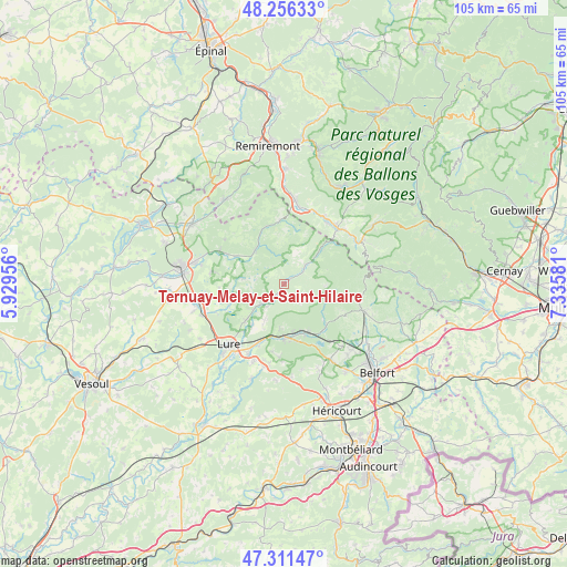
Ternuay-Melay-et-Saint-Hilaire GPS coordinates[2]
47° 47' 9.78" North, 6° 37' 57.684" East
| Map corner | latitude | longitude |
|---|---|---|
| Upper-left | 48.25633°, | 5.92956° |
| Center: | 47.78605°, | 6.63269° |
| Lower-right: | 47.31147°, | 7.33581° |
| Map W x H: | 105.1×105.1 km | = 65.3×65.3mi |
| max Lat: | 51.07786° ⇑44.5% North |
| Ternuay-Melay-et-Saint-Hilaire: | 47.78605° |
| min Lat: | ⇓55.5% South 41.3874° |
| min Long | Ternuay-Melay-e | max Long |
| -5.08615° | 6.63269° | 9.52242° |
| W 92.5%⇐ | ⇒7.5% E |
Elevation
Elevation of Ternuay-Melay-et-Saint-Hilaire is 352 m = 1155 ft, and this is 158.3 m = 519 ft above average elevation for this country.
| Max E: |
2333 m = 7654 ft | 14.5% |
| Ternuay-Melay-et-Saint-Hilaire | 352 m 1155 ft | |
| Avg. | 193.7 m = 635 ft | |
Min E: |
-1 m = -3 ft | 85.5% |
See also: France elevation on elevation.city.
Geographical zone
Ternuay-Melay-et-Saint-Hilaire is located in North temperate zone (between Tropic of Cancer and the Arctic Circle). Distance of this North polar circle is 2087.9 km =1297.4 mi to North.| Distance of | km | miles | from Ternuay-Melay-et-Saint-Hilaire |
|---|---|---|---|
| North Pole | 4693.8 | 2916.6 | to North |
| Arctic Circle | 2087.9 | 1297.4 | to North |
| Tropic Cancer | 2707.4 | 1682.3 | to South |
| Equator | 5313.3 | 3301.5 | to South |


Nearby cities:
15 places around Ternuay-Melay-et-Saint-Hilaire: (largest is in red/bold)
• Champagney
9.7 km =6 mi,  157°
157°
• Faucogney-et-la-Mer
8 km =5 mi,  320°
320°
• Fresse
2.6 km =1.6 mi,  179°
179°
• La Côte
11.9 km =7.4 mi,  202°
202°
• Le Thillot
14.2 km =8.8 mi,  43°
43°
• Lepuix
13.9 km =8.6 mi,  101°
101°
• Mélisey
5.4 km =3.4 mi,  226°
226°
• Plancher-Bas
10.4 km =6.5 mi,  135°
135°
• Plancher-les-Mines
8.7 km =5.4 mi,  108°
108°
• Raddon-et-Chapendu
13.5 km =8.4 mi,  298°
298°
• Ramonchamp
14.5 km =9 mi,  34°
34°
• Ronchamp
9.5 km =5.9 mi, 178°
• Saint-Barthélemy
5.4 km =3.4 mi,  222°
222°
• Saint-Germain
10.2 km =6.3 mi, 228°
• Servance
4.9 km =3 mi,  50°
50°
Sources, notices
• [Note1] Compared only with cities in France existing in our database
• [Src1] Map data: © OpenStreetMap contributors (CC-BY-SA)
• [Src2] Other city data from geonames.org with taken over terms of usage.
• [Src3] Geographical zone / Annual Mean Temperature by Robert A. Rohde @ Wikipedia
