Faucogney-et-la-Mer geodata
Faucogney-et-la-Mer (Bourgogne-Franche-Comté) is a populated place; located in France in Europe/Paris (GMT+2) time zone. With population of 605 people, there are 13241 cities with bigger population in this country. Compared to other cities in France, 56.5% of cities are located further ↓South; 92.1% of cities are located further ←West and 86.1% of cities have lower elevation than Faucogney-et-la-Mer. Note1
Administrative division(s):
- Level 1: Bourgogne-Franche-Comté
- Level 2: Département de la Haute-Saône
- Level 3: Arrondissement de Lure
- Level 4: Faucogney-et-la-Mer


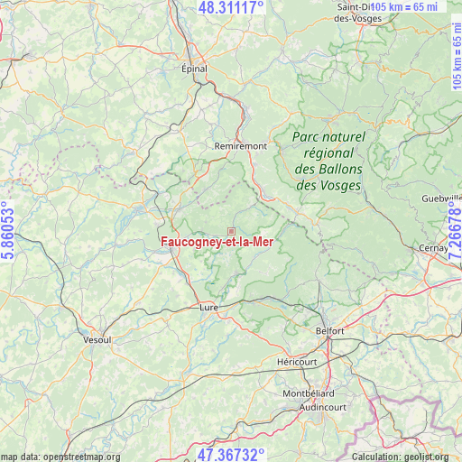
Faucogney-et-la-Mer GPS coordinates[2]
47° 50' 29.004" North, 6° 33' 49.14" East
| Map corner | latitude | longitude |
|---|---|---|
| Upper-left | 48.31117°, | 5.86053° |
| Center: | 47.84139°, | 6.56365° |
| Lower-right: | 47.36732°, | 7.26678° |
| Map W x H: | 104.9×104.9 km | = 65.2×65.2mi |
| max Lat: | 51.07786° ⇑43.5% North |
| Faucogney-et-la-Mer: | 47.84139° |
| min Lat: | ⇓56.5% South 41.3874° |
| min Long | Faucogney-et-la | max Long |
| -5.08615° | 6.56365° | 9.52242° |
| W 92.1%⇐ | ⇒7.9% E |
Elevation
Elevation of Faucogney-et-la-Mer is 361 m = 1184 ft, and this is 167.3 m = 549 ft above average elevation for this country.
| Max E: |
2333 m = 7654 ft | 13.9% |
| Faucogney-et-la-Mer | 361 m 1184 ft | |
| Avg. | 193.7 m = 635 ft | |
Min E: |
-1 m = -3 ft | 86.1% |
See also: France elevation on elevation.city.
Geographical zone
Faucogney-et-la-Mer is located in North temperate zone (between Tropic of Cancer and the Arctic Circle). Distance of this North polar circle is 2081.7 km =1293.5 mi to North.| Distance of | km | miles | from Faucogney-et-la-Mer |
|---|---|---|---|
| North Pole | 4687.6 | 2912.7 | to North |
| Arctic Circle | 2081.7 | 1293.5 | to North |
| Tropic Cancer | 2713.5 | 1686.1 | to South |
| Equator | 5319.5 | 3305.4 | to South |


Nearby cities:
15 places around Faucogney-et-la-Mer: (largest is in red/bold)
• Ferdrupt
13.1 km =8.1 mi,  56°
56°
• Fougerolles
12.8 km =8 mi,  292°
292°
• Fresse
10.2 km =6.3 mi,  149°
149°
• Froideconche
11.3 km =7 mi,  258°
258°
• Le Thillot
15.4 km =9.6 mi,  74°
74°
• Luxeuil-les-Bains
15.1 km =9.4 mi, 259°
• Mélisey
10 km =6.2 mi,  172°
172°
• Raddon-et-Chapendu
6.7 km =4.2 mi,  273°
273°
• Ramonchamp
14.5 km =9 mi, 66°
• Rupt-sur-Moselle
11.7 km =7.3 mi,  39°
39°
• Saint-Barthélemy
10.3 km =6.4 mi, 171°
• Saint-Germain
13.2 km =8.2 mi,  190°
190°
• Saint-Sauveur
13.9 km =8.6 mi,  253°
253°
• Servance
9.4 km =5.8 mi,  108°
108°
• Ternuay-Melay-et-Saint-Hilaire
8 km =5 mi,  140°
140°
Sources, notices
• [Note1] Compared only with cities in France existing in our database
• [Src1] Map data: © OpenStreetMap contributors (CC-BY-SA)
• [Src2] Other city data from geonames.org with taken over terms of usage.
• [Src3] Geographical zone / Annual Mean Temperature by Robert A. Rohde @ Wikipedia
