Lepuix geodata
Lepuix (Bourgogne-Franche-Comté) is a populated place; located in France in Europe/Paris (GMT+2) time zone. With population of 1,155 people, there are 7796 cities with bigger population in this country. Compared to other cities in France, 55.2% of cities are located further ↓South; 93.7% of cities are located further ←West and 93.1% of cities have lower elevation than Lepuix. Note1
Administrative division(s):
- Level 1: Bourgogne-Franche-Comté
- Level 2: Territoire de Belfort
- Level 3: Arrondissement de Belfort
- Level 4: Lepuix


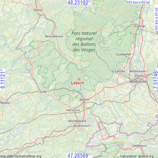
Lepuix GPS coordinates[2]
47° 45' 37.8" North, 6° 48' 51.624" East
| Map corner | latitude | longitude |
|---|---|---|
| Upper-left | 48.23102°, | 6.11121° |
| Center: | 47.7605°, | 6.81434° |
| Lower-right: | 47.28569°, | 7.51746° |
| Map W x H: | 105.1×105.1 km | = 65.3×65.3mi |
| max Lat: | 51.07786° ⇑44.8% North |
| Lepuix: | 47.7605° |
| min Lat: | ⇓55.2% South 41.3874° |
| min Long | Lepuix | max Long |
| -5.08615° | 6.81434° | 9.52242° |
| W 93.7%⇐ | ⇒6.3% E |
Elevation
Elevation of Lepuix is 509 m = 1670 ft, and this is 315.3 m = 1034 ft above average elevation for this country.
| Max E: |
2333 m = 7654 ft | 6.9% |
| Lepuix | 509 m 1670 ft | |
| Avg. | 193.7 m = 635 ft | |
Min E: |
-1 m = -3 ft | 93.1% |
See also: France elevation on elevation.city.
Geographical zone
Lepuix is located in North temperate zone (between Tropic of Cancer and the Arctic Circle). Distance of this North polar circle is 2090.7 km =1299.1 mi to North.| Distance of | km | miles | from Lepuix |
|---|---|---|---|
| North Pole | 4696.6 | 2918.3 | to North |
| Arctic Circle | 2090.7 | 1299.1 | to North |
| Tropic Cancer | 2704.6 | 1680.6 | to South |
| Equator | 5310.5 | 3299.8 | to South |


Nearby cities:
15 places around Lepuix: (largest is in red/bold)
• Anjoutey
11.1 km =6.9 mi,  126°
126°
• Chaux
5.3 km =3.3 mi,  162°
162°
• Giromagny
2.2 km =1.4 mi,  153°
153°
• Grosmagny
6.7 km =4.2 mi, 127°
• Lachapelle-sous-Chaux
6.2 km =3.9 mi,  175°
175°
• Plancher-Bas
7.7 km =4.8 mi,  234°
234°
• Plancher-les-Mines
5.3 km =3.3 mi,  271°
271°
• Rougegoutte
4 km =2.5 mi,  138°
138°
• Saint-Maurice-sur-Moselle
11 km =6.8 mi,  4°
4°
• Salbert
10.1 km =6.3 mi, 180°
• Sermamagny
7.9 km =4.9 mi,  167°
167°
• Sewen
8.6 km =5.3 mi,  52°
52°
• Valdoie
10.2 km =6.3 mi, 168°
• Vescemont
2.9 km =1.8 mi, 129°
• Éloie
9 km =5.6 mi, 150°
Sources, notices
• [Note1] Compared only with cities in France existing in our database
• [Src1] Map data: © OpenStreetMap contributors (CC-BY-SA)
• [Src2] Other city data from geonames.org with taken over terms of usage.
• [Src3] Geographical zone / Annual Mean Temperature by Robert A. Rohde @ Wikipedia
