Raddon-et-Chapendu geodata
Raddon-et-Chapendu (Bourgogne-Franche-Comté) is a populated place; located in France in Europe/Paris (GMT+2) time zone. With population of 857 people, there are 10014 cities with bigger population in this country. Compared to other cities in France, 56.5% of cities are located further ↓South; 91.6% of cities are located further ←West and 85.4% of cities have lower elevation than Raddon-et-Chapendu. Note1
Administrative division(s):
- Level 1: Bourgogne-Franche-Comté
- Level 2: Département de la Haute-Saône
- Level 3: Arrondissement de Lure
- Level 4: Raddon-et-Chapendu


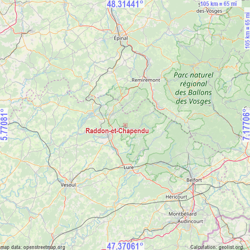
Raddon-et-Chapendu GPS coordinates[2]
47° 50' 40.776" North, 6° 28' 26.148" East
| Map corner | latitude | longitude |
|---|---|---|
| Upper-left | 48.31441°, | 5.77081° |
| Center: | 47.84466°, | 6.47393° |
| Lower-right: | 47.37061°, | 7.17706° |
| Map W x H: | 104.9×104.9 km | = 65.2×65.2mi |
| max Lat: | 51.07786° ⇑43.5% North |
| Raddon-et-Chapendu: | 47.84466° |
| min Lat: | ⇓56.5% South 41.3874° |
| min Long | Raddon-et-Chape | max Long |
| -5.08615° | 6.47393° | 9.52242° |
| W 91.6%⇐ | ⇒8.4% E |
Elevation
Elevation of Raddon-et-Chapendu is 351 m = 1152 ft, and this is 157.3 m = 516 ft above average elevation for this country.
| Max E: |
2333 m = 7654 ft | 14.6% |
| Raddon-et-Chapendu | 351 m 1152 ft | |
| Avg. | 193.7 m = 635 ft | |
Min E: |
-1 m = -3 ft | 85.4% |
See also: France elevation on elevation.city.
Geographical zone
Raddon-et-Chapendu is located in North temperate zone (between Tropic of Cancer and the Arctic Circle). Distance of this North polar circle is 2081.3 km =1293.3 mi to North.| Distance of | km | miles | from Raddon-et-Chapendu |
|---|---|---|---|
| North Pole | 4687.2 | 2912.5 | to North |
| Arctic Circle | 2081.3 | 1293.3 | to North |
| Tropic Cancer | 2713.9 | 1686.3 | to South |
| Equator | 5319.8 | 3305.6 | to South |


Nearby cities:
15 places around Raddon-et-Chapendu: (largest is in red/bold)
• Aillevillers-et-Lyaumont
13.2 km =8.2 mi,  309°
309°
• Baudoncourt
12.1 km =7.5 mi,  232°
232°
• Breuches
12 km =7.5 mi,  244°
244°
• Citers
12.4 km =7.7 mi,  202°
202°
• Corbenay
12 km =7.5 mi,  296°
296°
• Faucogney-et-la-Mer
6.7 km =4.2 mi,  93°
93°
• Fontaine-lès-Luxeuil
10.5 km =6.5 mi,  276°
276°
• Fougerolles
6.9 km =4.3 mi, 311°
• Froideconche
5.1 km =3.2 mi, 239°
• Luxeuil-les-Bains
8.7 km =5.4 mi,  249°
249°
• Mélisey
13 km =8.1 mi,  142°
142°
• Plombières-les-Bains
13.3 km =8.3 mi,  354°
354°
• Saint-Barthélemy
13.3 km =8.3 mi, 142°
• Saint-Sauveur
7.9 km =4.9 mi, 236°
• Ternuay-Melay-et-Saint-Hilaire
13.5 km =8.4 mi,  118°
118°
Sources, notices
• [Note1] Compared only with cities in France existing in our database
• [Src1] Map data: © OpenStreetMap contributors (CC-BY-SA)
• [Src2] Other city data from geonames.org with taken over terms of usage.
• [Src3] Geographical zone / Annual Mean Temperature by Robert A. Rohde @ Wikipedia
