Clamecy geodata
Clamecy (Bourgogne-Franche-Comté) is a seat of a third-order administrative division; located in France in Europe/Paris (GMT+2) time zone. With population of 4,531 people, there are 2180 cities with bigger population in this country. Compared to other cities in France, 50.6% of cities are located further ↓South; 64.4% of cities are located further ←West and 64.2% of cities have lower elevation than Clamecy. Note1
Administrative division(s):
- Level 1: Bourgogne-Franche-Comté
- Level 2: Département de la Nièvre
- Level 3: Arrondissement de Clamecy
- Level 4: Clamecy


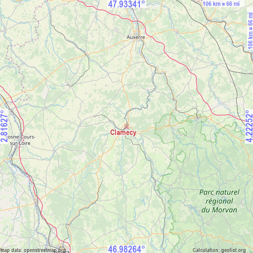
Clamecy GPS coordinates[2]
47° 27' 36.612" North, 3° 31' 9.84" East
| Map corner | latitude | longitude |
|---|---|---|
| Upper-left | 47.93341°, | 2.81627° |
| Center: | 47.46017°, | 3.5194° |
| Lower-right: | 46.98264°, | 4.22252° |
| Map W x H: | 105.7×105.7 km | = 65.7×65.7mi |
| max Lat: | 51.07786° ⇑49.4% North |
| Clamecy: | 47.46017° |
| min Lat: | ⇓50.6% South 41.3874° |
| min Long | Clamecy | max Long |
| -5.08615° | 3.5194° | 9.52242° |
| W 64.4%⇐ | ⇒35.6% E |
Elevation
Elevation of Clamecy is 190 m = 623 ft, and this is 3.7 m = 12 ft below average elevation for this country.
| Max E: |
2333 m = 7654 ft | 35.8% |
| Avg. | 193.7 m = 635 ft | |
| Clamecy | 190 m = 623 ft | |
Min E: |
-1 m = -3 ft | 64.2% |
See also: France elevation on elevation.city.
Geographical zone
Clamecy is located in North temperate zone (between Tropic of Cancer and the Arctic Circle). Distance of this North polar circle is 2124.1 km =1319.9 mi to North.| Distance of | km | miles | from Clamecy |
|---|---|---|---|
| North Pole | 4730 | 2939.1 | to North |
| Arctic Circle | 2124.1 | 1319.9 | to North |
| Tropic Cancer | 2671.2 | 1659.8 | to South |
| Equator | 5277.1 | 3279 | to South |


Nearby cities:
15 places around Clamecy: (largest is in red/bold)
• Châtel-Censoir
11.8 km =7.3 mi,  46°
46°
• Corbigny
25.7 km =16 mi,  151°
151°
• Coulanges-sur-Yonne
7.6 km =4.7 mi,  11°
11°
• Courson-les-Carrières
17.2 km =10.7 mi,  355°
355°
• Dornecy
5.6 km =3.5 mi,  118°
118°
• Entrains-sur-Nohain
19.8 km =12.3 mi,  271°
271°
• Fontenailles
10.9 km =6.8 mi,  336°
336°
• Mailly-la-Ville
19.9 km =12.4 mi,  37°
37°
• Mailly-le-Château
17.5 km =10.9 mi,  30°
30°
• Ouanne
23.5 km =14.6 mi, 341°
• Saints-en-Puisaye
26.3 km =16.3 mi,  312°
312°
• Tannay
11.6 km =7.2 mi, 152°
• Varzy
15.1 km =9.4 mi,  221°
221°
• Vézelay
17 km =10.6 mi,  87°
87°
• Étais-la-Sauvin
13.9 km =8.6 mi,  290°
290°
Sources, notices
• [Note1] Compared only with cities in France existing in our database
• [Src1] Map data: © OpenStreetMap contributors (CC-BY-SA)
• [Src2] Other city data from geonames.org with taken over terms of usage.
• [Src3] Geographical zone / Annual Mean Temperature by Robert A. Rohde @ Wikipedia
