Varzy geodata
Varzy (Bourgogne-Franche-Comté) is a populated place; located in France in Europe/Paris (GMT+2) time zone. With population of 1,473 people, there are 6285 cities with bigger population in this country. Compared to other cities in France, 50.6% of cities are located further ↑North; 63% of cities are located further ←West and 70.6% of cities have lower elevation than Varzy. Note1
Administrative division(s):
- Level 1: Bourgogne-Franche-Comté
- Level 2: Département de la Nièvre
- Level 3: Arrondissement de Clamecy
- Level 4: Varzy


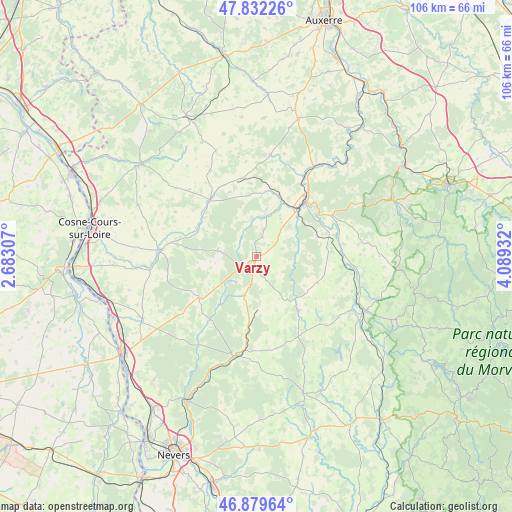
Varzy GPS coordinates[2]
47° 21' 29.16" North, 3° 23' 10.284" East
| Map corner | latitude | longitude |
|---|---|---|
| Upper-left | 47.83226°, | 2.68307° |
| Center: | 47.3581°, | 3.38619° |
| Lower-right: | 46.87964°, | 4.08932° |
| Map W x H: | 105.9×105.9 km | = 65.8×65.8mi |
| max Lat: | 51.07786° ⇑50.6% North |
| Varzy: | 47.3581° |
| min Lat: | ⇓49.4% South 41.3874° |
| min Long | Varzy | max Long |
| -5.08615° | 3.38619° | 9.52242° |
| W 63%⇐ | ⇒37% E |
Elevation
Elevation of Varzy is 222 m = 728 ft, and this is 28.3 m = 93 ft above average elevation for this country.
| Max E: |
2333 m = 7654 ft | 29.4% |
| Varzy | 222 m 728 ft | |
| Avg. | 193.7 m = 635 ft | |
Min E: |
-1 m = -3 ft | 70.6% |
See also: France elevation on elevation.city.
Geographical zone
Varzy is located in North temperate zone (between Tropic of Cancer and the Arctic Circle). Distance of this North polar circle is 2135.4 km =1326.9 mi to North.| Distance of | km | miles | from Varzy |
|---|---|---|---|
| North Pole | 4741.3 | 2946.1 | to North |
| Arctic Circle | 2135.4 | 1326.9 | to North |
| Tropic Cancer | 2659.8 | 1652.7 | to South |
| Equator | 5265.7 | 3272 | to South |


Nearby cities:
15 places around Varzy: (largest is in red/bold)
• Alligny-Cosne
26.7 km =16.6 mi,  293°
293°
• Châteauneuf-Val-de-Bargis
14.7 km =9.1 mi,  234°
234°
• Châtel-Censoir
27 km =16.8 mi,  43°
43°
• Clamecy
15.1 km =9.4 mi, 41°
• Corbigny
25 km =15.5 mi,  116°
116°
• Coulanges-sur-Yonne
22 km =13.7 mi,  31°
31°
• Donzy
19.7 km =12.2 mi,  274°
274°
• Dornecy
17.3 km =10.7 mi,  59°
59°
• Entrains-sur-Nohain
15.3 km =9.5 mi,  320°
320°
• Fontenailles
22.1 km =13.7 mi,  14°
14°
• Prémery
21.4 km =13.3 mi,  191°
191°
• Suilly-la-Tour
24.4 km =15.2 mi,  264°
264°
• Tannay
15.5 km =9.6 mi,  85°
85°
• Treigny
26.2 km =16.3 mi, 324°
• Étais-la-Sauvin
16.5 km =10.3 mi,  349°
349°
Sources, notices
• [Note1] Compared only with cities in France existing in our database
• [Src1] Map data: © OpenStreetMap contributors (CC-BY-SA)
• [Src2] Other city data from geonames.org with taken over terms of usage.
• [Src3] Geographical zone / Annual Mean Temperature by Robert A. Rohde @ Wikipedia
