Eckwersheim geodata
Eckwersheim (Grand Est) is a populated place; located in France in Europe/Paris (GMT+2) time zone. With population of 1,337 people, there are 6873 cities with bigger population in this country. Compared to other cities in France, 72.8% of cities are located further ↓South; 99% of cities are located further ←West and 55% of cities have lower elevation than Eckwersheim. Note1
Administrative division(s):
- Level 1: Grand Est
- Level 2: Bas-Rhin
- Level 3: Arrondissement de Strasbourg
- Level 4: Eckwersheim


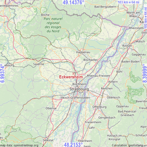
Eckwersheim GPS coordinates[2]
48° 40' 54.012" North, 7° 41' 48.732" East
| Map corner | latitude | longitude |
|---|---|---|
| Upper-left | 49.14376°, | 6.99374° |
| Center: | 48.68167°, | 7.69687° |
| Lower-right: | 48.2153°, | 8.39999° |
| Map W x H: | 103.2×103.2 km | = 64.1×64.1mi |
| max Lat: | 51.07786° ⇑27.2% North |
| Eckwersheim: | 48.68167° |
| min Lat: | ⇓72.8% South 41.3874° |
| min Long | Eckwersheim | max Long |
| -5.08615° | 7.69687° | 9.52242° |
| W 99%⇐ | ⇒1% E |
Elevation
Elevation of Eckwersheim is 150 m = 492 ft, and this is 43.7 m = 143 ft below average elevation for this country.
| Max E: |
2333 m = 7654 ft | 45% |
| Avg. | 193.7 m = 635 ft | |
| Eckwersheim | 150 m = 492 ft | |
Min E: |
-1 m = -3 ft | 55% |
See also: France elevation on elevation.city.
Geographical zone
Eckwersheim is located in North temperate zone (between Tropic of Cancer and the Arctic Circle). Distance of this North polar circle is 1988.3 km =1235.5 mi to North.| Distance of | km | miles | from Eckwersheim |
|---|---|---|---|
| North Pole | 4594.2 | 2854.7 | to North |
| Arctic Circle | 1988.3 | 1235.5 | to North |
| Tropic Cancer | 2807 | 1744.2 | to South |
| Equator | 5412.9 | 3363.4 | to South |


Nearby cities:
15 places around Eckwersheim: (largest is in red/bold)
• Berstett
2.9 km =1.8 mi,  264°
264°
• Brumath
5.9 km =3.7 mi,  10°
10°
• Dingsheim
6 km =3.7 mi,  199°
199°
• Geudertheim
6.2 km =3.9 mi,  40°
40°
• Griesheim-sur-Souffel
5.5 km =3.4 mi, 201°
• Lampertheim
3.4 km =2.1 mi,  177°
177°
• Mittelhausen
5.8 km =3.6 mi,  301°
301°
• Mundolsheim
4.6 km =2.9 mi,  164°
164°
• Niederhausbergen
6.4 km =4 mi, 176°
• Olwisheim
2.4 km =1.5 mi,  316°
316°
• Pfettisheim
4.5 km =2.8 mi,  237°
237°
• Pfulgriesheim
4.6 km =2.9 mi, 204°
• Reichstett
5.6 km =3.5 mi,  130°
130°
• Souffelweyersheim
6.1 km =3.8 mi,  147°
147°
• Vendenheim
1.7 km =1.1 mi,  144°
144°
Sources, notices
• [Note1] Compared only with cities in France existing in our database
• [Src1] Map data: © OpenStreetMap contributors (CC-BY-SA)
• [Src2] Other city data from geonames.org with taken over terms of usage.
• [Src3] Geographical zone / Annual Mean Temperature by Robert A. Rohde @ Wikipedia
