Sonzay geodata
Sonzay (Centre) is a populated place; located in France in Europe/Paris (GMT+2) time zone. With population of 1,172 people, there are 7694 cities with bigger population in this country. Compared to other cities in France, 51.6% of cities are located further ↓South; 73.8% of cities are located further →East and 59.4% of cities have higher elevation than Sonzay. Note1
Administrative division(s):
- Level 1: Centre
- Level 2: Département d'Indre-et-Loire
- Level 3: Arrondissement de Chinon
- Level 4: Sonzay


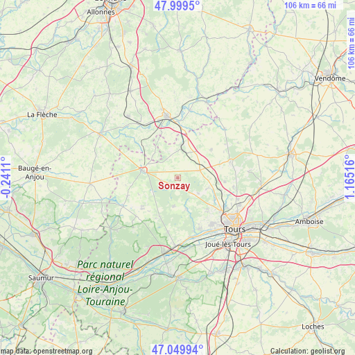
Sonzay GPS coordinates[2]
47° 31' 36.732" North, 0° 27' 43.308" East
| Map corner | latitude | longitude |
|---|---|---|
| Upper-left | 47.9995°, | -0.2411° |
| Center: | 47.52687°, | 0.46203° |
| Lower-right: | 47.04994°, | 1.16516° |
| Map W x H: | 105.6×105.6 km | = 65.6×65.6mi |
| max Lat: | 51.07786° ⇑48.4% North |
| Sonzay: | 47.52687° |
| min Lat: | ⇓51.6% South 41.3874° |
| min Long | Sonzay | max Long |
| -5.08615° | 0.46203° | 9.52242° |
| W 26.2%⇐ | ⇒73.8% E |
Elevation
Elevation of Sonzay is 104 m = 341 ft, and this is 89.7 m = 294 ft below average elevation for this country.
| Max E: |
2333 m = 7654 ft | 59.4% |
| Avg. | 193.7 m = 635 ft | |
| Sonzay | 104 m = 341 ft | |
Min E: |
-1 m = -3 ft | 40.6% |
See also: France elevation on elevation.city.
Geographical zone
Sonzay is located in North temperate zone (between Tropic of Cancer and the Arctic Circle). Distance of this North polar circle is 2116.7 km =1315.3 mi to North.| Distance of | km | miles | from Sonzay |
|---|---|---|---|
| North Pole | 4722.6 | 2934.5 | to North |
| Arctic Circle | 2116.7 | 1315.3 | to North |
| Tropic Cancer | 2678.6 | 1664.4 | to South |
| Equator | 5284.5 | 3283.6 | to South |


Nearby cities:
15 places around Sonzay: (largest is in red/bold)
• Ambillou
8.5 km =5.3 mi,  187°
187°
• Charentilly
12.7 km =7.9 mi,  119°
119°
• Château-la-Vallière
10.5 km =6.5 mi,  282°
282°
• Cléré-les-Pins
12.5 km =7.8 mi,  205°
205°
• Couesmes
9.9 km =6.2 mi,  294°
294°
• Neuillé-Pont-Pierre
7 km =4.3 mi,  69°
69°
• Neuvy-le-Roi
13.1 km =8.1 mi,  49°
49°
• Pernay
9.7 km =6 mi,  162°
162°
• Saint-Antoine-du-Rocher
13 km =8.1 mi,  104°
104°
• Saint-Christophe-sur-le-Nais
10.1 km =6.3 mi,  6°
6°
• Saint-Paterne-Racan
8.5 km =5.3 mi, 11°
• Saint-Roch
13.2 km =8.2 mi,  135°
135°
• Semblançay
9.6 km =6 mi,  108°
108°
• Souvigné
4.9 km =3 mi,  263°
263°
• Villiers-au-Bouin
12.4 km =7.7 mi,  295°
295°
Sources, notices
• [Note1] Compared only with cities in France existing in our database
• [Src1] Map data: © OpenStreetMap contributors (CC-BY-SA)
• [Src2] Other city data from geonames.org with taken over terms of usage.
• [Src3] Geographical zone / Annual Mean Temperature by Robert A. Rohde @ Wikipedia
