Tigery geodata
Tigery (Île-de-France) is a populated place; located in France in Europe/Paris (GMT+2) time zone. With population of 1,406 people, there are 6585 cities with bigger population in this country. Compared to other cities in France, 71.9% of cities are located further ↓South; 50.7% of cities are located further ←West and 71% of cities have higher elevation than Tigery. Note1
Administrative division(s):
- Level 1: Île-de-France
- Level 2: Département de l'Essonne
- Level 3: Arrondissement d'Évry
- Level 4: Tigery


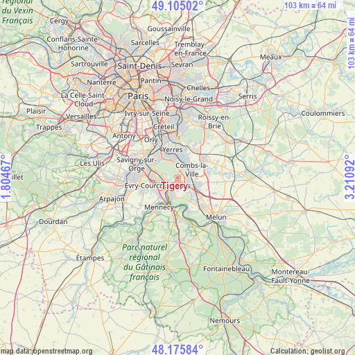
Tigery GPS coordinates[2]
48° 38' 33.252" North, 2° 30' 28.044" East
| Map corner | latitude | longitude |
|---|---|---|
| Upper-left | 49.10502°, | 1.80467° |
| Center: | 48.64257°, | 2.50779° |
| Lower-right: | 48.17584°, | 3.21092° |
| Map W x H: | 103.3×103.3 km | = 64.2×64.2mi |
| max Lat: | 51.07786° ⇑28.1% North |
| Tigery: | 48.64257° |
| min Lat: | ⇓71.9% South 41.3874° |
| min Long | Tigery | max Long |
| -5.08615° | 2.50779° | 9.52242° |
| W 50.7%⇐ | ⇒49.3% E |
Elevation
Elevation of Tigery is 76 m = 249 ft, and this is 117.7 m = 386 ft below average elevation for this country.
| Max E: |
2333 m = 7654 ft | 71% |
| Avg. | 193.7 m = 635 ft | |
| Tigery | 76 m = 249 ft | |
Min E: |
-1 m = -3 ft | 29% |
See also: France elevation on elevation.city.
Geographical zone
Tigery is located in North temperate zone (between Tropic of Cancer and the Arctic Circle). Distance of this North polar circle is 1992.6 km =1238.1 mi to North.| Distance of | km | miles | from Tigery |
|---|---|---|---|
| North Pole | 4598.5 | 2857.4 | to North |
| Arctic Circle | 1992.6 | 1238.1 | to North |
| Tropic Cancer | 2802.6 | 1741.5 | to South |
| Equator | 5408.5 | 3360.7 | to South |


Nearby cities:
15 places around Tigery: (largest is in red/bold)
• Boussy-Saint-Antoine
5.6 km =3.5 mi,  17°
17°
• Brunoy
5.9 km =3.7 mi,  348°
348°
• Combs-la-Ville
5.2 km =3.2 mi,  61°
61°
• Corbeil-Essonnes
4.3 km =2.7 mi,  200°
200°
• Lieusaint
3.1 km =1.9 mi,  106°
106°
• Périgny
6.9 km =4.3 mi,  30°
30°
• Quincy-sous-Sénart
3.9 km =2.4 mi, 29°
• Saint-Germain-lès-Corbeil
2.7 km =1.7 mi,  212°
212°
• Saint-Pierre-du-Perray
3.7 km =2.3 mi, 195°
• Saintry-sur-Seine
5.2 km =3.2 mi,  190°
190°
• Soisy-sur-Seine
4.1 km =2.5 mi,  279°
279°
• Varennes-Jarcy
5.7 km =3.5 mi,  44°
44°
• Épinay-sous-Sénart
5.2 km =3.2 mi,  3°
3°
• Étiolles
2.2 km =1.4 mi,  239°
239°
• Évry
5.1 km =3.2 mi,  257°
257°
Sources, notices
• [Note1] Compared only with cities in France existing in our database
• [Src1] Map data: © OpenStreetMap contributors (CC-BY-SA)
• [Src2] Other city data from geonames.org with taken over terms of usage.
• [Src3] Geographical zone / Annual Mean Temperature by Robert A. Rohde @ Wikipedia
