Brunoy geodata
Brunoy (Île-de-France) is a populated place; located in France in Europe/Paris (GMT+2) time zone. With population of 24,096 people, there are 369 cities with bigger population in this country. Compared to other cities in France, 73.1% of cities are located further ↓South; 50.5% of cities are located further ←West and 68.7% of cities have higher elevation than Brunoy. Note1
Administrative division(s):
- Level 1: Île-de-France
- Level 2: Département de l'Essonne
- Level 3: Arrondissement d'Évry
- Level 4: Brunoy


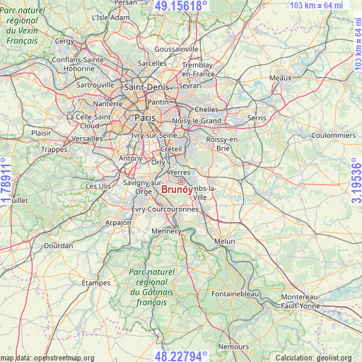
Brunoy GPS coordinates[2]
48° 41' 39.12" North, 2° 29' 32.028" East
| Map corner | latitude | longitude |
|---|---|---|
| Upper-left | 49.15618°, | 1.78911° |
| Center: | 48.6942°, | 2.49223° |
| Lower-right: | 48.22794°, | 3.19536° |
| Map W x H: | 103.2×103.2 km | = 64.1×64.1mi |
| max Lat: | 51.07786° ⇑26.9% North |
| Brunoy: | 48.6942° |
| min Lat: | ⇓73.1% South 41.3874° |
| min Long | Brunoy | max Long |
| -5.08615° | 2.49223° | 9.52242° |
| W 50.5%⇐ | ⇒49.5% E |
Elevation
Elevation of Brunoy is 81 m = 266 ft, and this is 112.7 m = 370 ft below average elevation for this country.
| Max E: |
2333 m = 7654 ft | 68.7% |
| Avg. | 193.7 m = 635 ft | |
| Brunoy | 81 m = 266 ft | |
Min E: |
-1 m = -3 ft | 31.3% |
See also: France elevation on elevation.city.
Geographical zone
Brunoy is located in North temperate zone (between Tropic of Cancer and the Arctic Circle). Distance of this North polar circle is 1986.9 km =1234.6 mi to North.| Distance of | km | miles | from Brunoy |
|---|---|---|---|
| North Pole | 4592.8 | 2853.8 | to North |
| Arctic Circle | 1986.9 | 1234.6 | to North |
| Tropic Cancer | 2808.4 | 1745.1 | to South |
| Equator | 5414.3 | 3364.3 | to South |


Nearby cities:
15 places around Brunoy: (largest is in red/bold)
• Boussy-Saint-Antoine
2.8 km =1.7 mi,  97°
97°
• Crosne
3.8 km =2.4 mi,  317°
317°
• Draveil
5.8 km =3.6 mi,  259°
259°
• Limeil-Brévannes
5.6 km =3.5 mi,  356°
356°
• Mandres-les-Roses
4.1 km =2.5 mi,  77°
77°
• Montgeron
3.3 km =2.1 mi,  292°
292°
• Périgny
4.6 km =2.9 mi,  86°
86°
• Quincy-sous-Sénart
3.9 km =2.4 mi,  127°
127°
• Soisy-sur-Seine
5.8 km =3.6 mi,  210°
210°
• Tigery
5.9 km =3.7 mi,  168°
168°
• Varennes-Jarcy
5.4 km =3.4 mi,  108°
108°
• Villecresnes
4.5 km =2.8 mi,  50°
50°
• Villeneuve-Saint-Georges
5.3 km =3.3 mi, 323°
• Yerres
2.6 km =1.6 mi,  1°
1°
• Épinay-sous-Sénart
1.5 km =0.9 mi, 109°
Sources, notices
• [Note1] Compared only with cities in France existing in our database
• [Src1] Map data: © OpenStreetMap contributors (CC-BY-SA)
• [Src2] Other city data from geonames.org with taken over terms of usage.
• [Src3] Geographical zone / Annual Mean Temperature by Robert A. Rohde @ Wikipedia
