Scorbé-Clairvaux geodata
Scorbé-Clairvaux (Nouvelle-Aquitaine) is a populated place; located in France in Europe/Paris (GMT+2) time zone. With population of 2,288 people, there are 4211 cities with bigger population in this country. Compared to other cities in France, 57.1% of cities are located further ↑North; 74.2% of cities are located further →East and 64.9% of cities have higher elevation than Scorbé-Clairvaux. Note1
Administrative division(s):
- Level 1: Nouvelle-Aquitaine
- Level 2: Vienne
- Level 3: Arrondissement de Châtellerault
- Level 4: Scorbé-Clairvaux


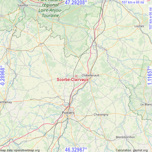
Scorbé-Clairvaux GPS coordinates[2]
46° 48' 46.908" North, 0° 24' 48.384" East
| Map corner | latitude | longitude |
|---|---|---|
| Upper-left | 47.29208°, | -0.28968° |
| Center: | 46.81303°, | 0.41344° |
| Lower-right: | 46.32967°, | 1.11657° |
| Map W x H: | 107×107 km | = 66.5×66.5mi |
| max Lat: | 51.07786° ⇑57.1% North |
| Scorbé-Clairvaux: | 46.81303° |
| min Lat: | ⇓42.9% South 41.3874° |
| min Long | Scorbé-Clairva | max Long |
| -5.08615° | 0.41344° | 9.52242° |
| W 25.8%⇐ | ⇒74.2% E |
Elevation
Elevation of Scorbé-Clairvaux is 90 m = 295 ft, and this is 103.7 m = 340 ft below average elevation for this country.
| Max E: |
2333 m = 7654 ft | 64.9% |
| Avg. | 193.7 m = 635 ft | |
| Scorbé-Clairvaux | 90 m = 295 ft | |
Min E: |
-1 m = -3 ft | 35.1% |
See also: France elevation on elevation.city.
Geographical zone
Scorbé-Clairvaux is located in North temperate zone (between Tropic of Cancer and the Arctic Circle). Distance of this North polar circle is 2196.1 km =1364.6 mi to North.| Distance of | km | miles | from Scorbé-Clairvaux |
|---|---|---|---|
| North Pole | 4801.9 | 2983.8 | to North |
| Arctic Circle | 2196.1 | 1364.6 | to North |
| Tropic Cancer | 2599.2 | 1615.1 | to South |
| Equator | 5205.1 | 3234.3 | to South |


Nearby cities:
15 places around Scorbé-Clairvaux: (largest is in red/bold)
• Antran
10.8 km =6.7 mi,  64°
64°
• Beaumont
8.5 km =5.3 mi,  171°
171°
• Cenon-sur-Vienne
10.3 km =6.4 mi,  114°
114°
• Châtellerault
10 km =6.2 mi,  87°
87°
• Colombiers
4.6 km =2.9 mi, 168°
• Dissay
12.6 km =7.8 mi, 173°
• Doussay
11 km =6.8 mi,  287°
287°
• Lencloître
6.5 km =4 mi,  271°
271°
• Marigny-Brizay
7.9 km =4.9 mi,  200°
200°
• Naintré
7.7 km =4.8 mi,  136°
136°
• Saint-Cyr
10.7 km =6.6 mi, 168°
• Saint-Gervais-les-Trois-Clochers
9.8 km =6.1 mi,  357°
357°
• Thuré
4.1 km =2.5 mi, 59°
• Usseau
10.1 km =6.3 mi,  46°
46°
• Vendeuvre-du-Poitou
11.7 km =7.3 mi,  222°
222°
Sources, notices
• [Note1] Compared only with cities in France existing in our database
• [Src1] Map data: © OpenStreetMap contributors (CC-BY-SA)
• [Src2] Other city data from geonames.org with taken over terms of usage.
• [Src3] Geographical zone / Annual Mean Temperature by Robert A. Rohde @ Wikipedia
