Cenon-sur-Vienne geodata
Cenon-sur-Vienne (Nouvelle-Aquitaine) is a populated place; located in France in Europe/Paris (GMT+2) time zone. With population of 1,835 people, there are 5165 cities with bigger population in this country. Compared to other cities in France, 57.5% of cities are located further ↑North; 73.1% of cities are located further →East and 80.2% of cities have higher elevation than Cenon-sur-Vienne. Note1
Administrative division(s):
- Level 1: Nouvelle-Aquitaine
- Level 2: Vienne
- Level 3: Arrondissement de Châtellerault
- Level 4: Cenon-sur-Vienne


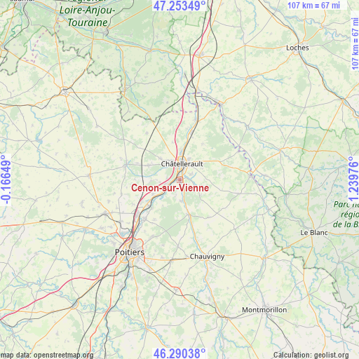
Cenon-sur-Vienne GPS coordinates[2]
46° 46' 26.724" North, 0° 32' 11.868" East
| Map corner | latitude | longitude |
|---|---|---|
| Upper-left | 47.25349°, | -0.16649° |
| Center: | 46.77409°, | 0.53663° |
| Lower-right: | 46.29038°, | 1.23976° |
| Map W x H: | 107.1×107.1 km | = 66.5×66.5mi |
| max Lat: | 51.07786° ⇑57.5% North |
| Cenon-sur-Vienne: | 46.77409° |
| min Lat: | ⇓42.5% South 41.3874° |
| min Long | Cenon-sur-Vienn | max Long |
| -5.08615° | 0.53663° | 9.52242° |
| W 26.9%⇐ | ⇒73.1% E |
Elevation
Elevation of Cenon-sur-Vienne is 54 m = 177 ft, and this is 139.7 m = 458 ft below average elevation for this country.
| Max E: |
2333 m = 7654 ft | 80.2% |
| Avg. | 193.7 m = 635 ft | |
| Cenon-sur-Vienne | 54 m = 177 ft | |
Min E: |
-1 m = -3 ft | 19.8% |
See also: France elevation on elevation.city.
Geographical zone
Cenon-sur-Vienne is located in North temperate zone (between Tropic of Cancer and the Arctic Circle). Distance of this North polar circle is 2200.4 km =1367.3 mi to North.| Distance of | km | miles | from Cenon-sur-Vienne |
|---|---|---|---|
| North Pole | 4806.3 | 2986.5 | to North |
| Arctic Circle | 2200.4 | 1367.3 | to North |
| Tropic Cancer | 2594.9 | 1612.4 | to South |
| Equator | 5200.8 | 3231.6 | to South |


Nearby cities:
15 places around Cenon-sur-Vienne: (largest is in red/bold)
• Antran
9 km =5.6 mi,  2°
2°
• Beaumont
9.1 km =5.7 mi,  243°
243°
• Bonneuil-Matours
10.6 km =6.6 mi,  166°
166°
• Châtellerault
4.8 km =3 mi,  7°
7°
• Colombiers
8.5 km =5.3 mi,  268°
268°
• Dissay
11.4 km =7.1 mi,  224°
224°
• Monthoiron
7.7 km =4.8 mi,  125°
125°
• Naintré
4.3 km =2.7 mi,  252°
252°
• Saint-Cyr
9.5 km =5.9 mi,  229°
229°
• Saint-Sauveur
7.6 km =4.7 mi,  60°
60°
• Scorbé-Clairvaux
10.3 km =6.4 mi,  294°
294°
• Senillé
5.9 km =3.7 mi,  85°
85°
• Thuré
8.7 km =5.4 mi,  317°
317°
• Usseau
11.5 km =7.1 mi,  349°
349°
• Vouneuil-sur-Vienne
6.3 km =3.9 mi,  177°
177°
Sources, notices
• [Note1] Compared only with cities in France existing in our database
• [Src1] Map data: © OpenStreetMap contributors (CC-BY-SA)
• [Src2] Other city data from geonames.org with taken over terms of usage.
• [Src3] Geographical zone / Annual Mean Temperature by Robert A. Rohde @ Wikipedia
