Saint-Gervais-les-Trois-Clochers geodata
Saint-Gervais-les-Trois-Clochers (Nouvelle-Aquitaine) is a populated place; located in France in Europe/Paris (GMT+2) time zone. With population of 1,262 people, there are 7220 cities with bigger population in this country. Compared to other cities in France, 56.2% of cities are located further ↑North; 74.2% of cities are located further →East and 67.8% of cities have higher elevation than Saint-Gervais-les-Trois-Clochers. Note1
Administrative division(s):
- Level 1: Nouvelle-Aquitaine
- Level 2: Vienne
- Level 3: Arrondissement de Châtellerault
- Level 4: Saint-Gervais-les-Trois-Clochers
Current local time in Saint-Gervais-les-Trois-Clochers:
11:32 AM, SaturdayDifference from your time zone: hours


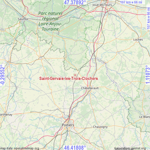
Saint-Gervais-les-Trois-Clochers GPS coordinates[2]
46° 54' 2.34" North, 0° 24' 27.36" East
| Map corner | latitude | longitude |
|---|---|---|
| Upper-left | 47.37892°, | -0.29552° |
| Center: | 46.90065°, | 0.4076° |
| Lower-right: | 46.41808°, | 1.11073° |
| Map W x H: | 106.8×106.8 km | = 66.4×66.4mi |
| max Lat: | 51.07786° ⇑56.2% North |
| Saint-Gervais-les-Trois-Clochers: | 46.90065° |
| min Lat: | ⇓43.8% South 41.3874° |
| min Long | Saint-Gervais-l | max Long |
| -5.08615° | 0.4076° | 9.52242° |
| W 25.8%⇐ | ⇒74.2% E |
Elevation
Elevation of Saint-Gervais-les-Trois-Clochers is 83 m = 272 ft, and this is 110.7 m = 363 ft below average elevation for this country.
| Max E: |
2333 m = 7654 ft | 67.8% |
| Avg. | 193.7 m = 635 ft | |
| Saint-Gervais-les-Trois-Clochers | 83 m = 272 ft | |
Min E: |
-1 m = -3 ft | 32.2% |
See also: France elevation on elevation.city.
Geographical zone
Saint-Gervais-les-Trois-Clochers is located in North temperate zone (between Tropic of Cancer and the Arctic Circle). Distance of this North polar circle is 2186.3 km =1358.5 mi to North.| Distance of | km | miles | from Saint-Gervais-les-Trois-Clochers |
|---|---|---|---|
| North Pole | 4792.2 | 2977.7 | to North |
| Arctic Circle | 2186.3 | 1358.5 | to North |
| Tropic Cancer | 2608.9 | 1621.1 | to South |
| Equator | 5214.9 | 3240.4 | to South |


Nearby cities:
15 places around Saint-Gervais-les-Trois-Clochers: (largest is in red/bold)
• Antran
11.4 km =7.1 mi,  116°
116°
• Chaveignes
15.9 km =9.9 mi,  344°
344°
• Châtellerault
14 km =8.7 mi,  131°
131°
• Colombiers
14.3 km =8.9 mi,  174°
174°
• Dangé-Saint-Romain
15.1 km =9.4 mi,  76°
76°
• Doussay
11.9 km =7.4 mi,  237°
237°
• Lencloître
11.3 km =7 mi,  212°
212°
• Marigny-Marmande
10.9 km =6.8 mi,  34°
34°
• Monts-sur-Guesnes
15 km =9.3 mi,  277°
277°
• Pouant
15.6 km =9.7 mi,  318°
318°
• Richelieu
14.1 km =8.8 mi,  333°
333°
• Scorbé-Clairvaux
9.8 km =6.1 mi,  177°
177°
• Thuré
8.6 km =5.3 mi,  152°
152°
• Usseau
8.2 km =5.1 mi,  109°
109°
• Vaux-sur-Vienne
12.2 km =7.6 mi, 83°
Sources, notices
• [Note1] Compared only with cities in France existing in our database
• [Src1] Map data: © OpenStreetMap contributors (CC-BY-SA)
• [Src2] Other city data from geonames.org with taken over terms of usage.
• [Src3] Geographical zone / Annual Mean Temperature by Robert A. Rohde @ Wikipedia
