Luxeuil-les-Bains geodata
Luxeuil-les-Bains (Bourgogne-Franche-Comté) is a populated place; located in France in Europe/Paris (GMT+2) time zone. With population of 9,200 people, there are 1043 cities with bigger population in this country. Compared to other cities in France, 56% of cities are located further ↓South; 90.8% of cities are located further ←West and 80.8% of cities have lower elevation than Luxeuil-les-Bains. Note1
Administrative division(s):
- Level 1: Bourgogne-Franche-Comté
- Level 2: Département de la Haute-Saône
- Level 3: Arrondissement de Lure
- Level 4: Luxeuil-les-Bains


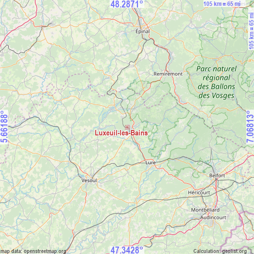
Luxeuil-les-Bains GPS coordinates[2]
47° 49' 1.56" North, 6° 21' 54" East
| Map corner | latitude | longitude |
|---|---|---|
| Upper-left | 48.2871°, | 5.66188° |
| Center: | 47.8171°, | 6.365° |
| Lower-right: | 47.3428°, | 7.06813° |
| Map W x H: | 105×105 km | = 65.2×65.2mi |
| max Lat: | 51.07786° ⇑44% North |
| Luxeuil-les-Bains: | 47.8171° |
| min Lat: | ⇓56% South 41.3874° |
| min Long | Luxeuil-les-Bai | max Long |
| -5.08615° | 6.365° | 9.52242° |
| W 90.8%⇐ | ⇒9.2% E |
Elevation
Elevation of Luxeuil-les-Bains is 299 m = 981 ft, and this is 105.3 m = 345 ft above average elevation for this country.
| Max E: |
2333 m = 7654 ft | 19.2% |
| Luxeuil-les-Bains | 299 m 981 ft | |
| Avg. | 193.7 m = 635 ft | |
Min E: |
-1 m = -3 ft | 80.8% |
See also: France elevation on elevation.city.
Geographical zone
Luxeuil-les-Bains is located in North temperate zone (between Tropic of Cancer and the Arctic Circle). Distance of this North polar circle is 2084.4 km =1295.2 mi to North.| Distance of | km | miles | from Luxeuil-les-Bains |
|---|---|---|---|
| North Pole | 4690.3 | 2914.4 | to North |
| Arctic Circle | 2084.4 | 1295.2 | to North |
| Tropic Cancer | 2710.8 | 1684.4 | to South |
| Equator | 5316.8 | 3303.7 | to South |


Nearby cities:
15 places around Luxeuil-les-Bains: (largest is in red/bold)
• Aillevillers-et-Lyaumont
11.7 km =7.3 mi,  349°
349°
• Baudoncourt
4.5 km =2.8 mi,  198°
198°
• Breuches
3.4 km =2.1 mi,  233°
233°
• Citers
9 km =5.6 mi,  158°
158°
• Conflans-sur-Lanterne
11.1 km =6.9 mi,  269°
269°
• Corbenay
8.8 km =5.5 mi,  342°
342°
• Faucogney-et-la-Mer
15.1 km =9.4 mi,  79°
79°
• Fontaine-lès-Luxeuil
4.9 km =3 mi,  332°
332°
• Fougerolles
8.1 km =5 mi,  21°
21°
• Froideconche
3.8 km =2.4 mi, 83°
• Raddon-et-Chapendu
8.7 km =5.4 mi,  69°
69°
• Saint-Germain
16.1 km =10 mi,  129°
129°
• Saint-Loup-sur-Semouse
10 km =6.2 mi,  317°
317°
• Saint-Sauveur
2 km =1.2 mi, 130°
• Saulx
14.4 km =8.9 mi,  205°
205°
Sources, notices
• [Note1] Compared only with cities in France existing in our database
• [Src1] Map data: © OpenStreetMap contributors (CC-BY-SA)
• [Src2] Other city data from geonames.org with taken over terms of usage.
• [Src3] Geographical zone / Annual Mean Temperature by Robert A. Rohde @ Wikipedia
