Breuches geodata
Breuches (Bourgogne-Franche-Comté) is a populated place; located in France in Europe/Paris (GMT+2) time zone. With population of 774 people, there are 10892 cities with bigger population in this country. Compared to other cities in France, 55.7% of cities are located further ↓South; 90.5% of cities are located further ←West and 76.1% of cities have lower elevation than Breuches. Note1
Administrative division(s):
- Level 1: Bourgogne-Franche-Comté
- Level 2: Département de la Haute-Saône
- Level 3: Arrondissement de Lure
- Level 4: Breuches


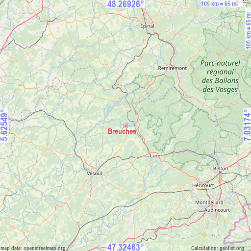
Breuches GPS coordinates[2]
47° 47' 56.724" North, 6° 19' 42.996" East
| Map corner | latitude | longitude |
|---|---|---|
| Upper-left | 48.26926°, | 5.62549° |
| Center: | 47.79909°, | 6.32861° |
| Lower-right: | 47.32463°, | 7.03174° |
| Map W x H: | 105×105 km | = 65.2×65.2mi |
| max Lat: | 51.07786° ⇑44.3% North |
| Breuches: | 47.79909° |
| min Lat: | ⇓55.7% South 41.3874° |
| min Long | Breuches | max Long |
| -5.08615° | 6.32861° | 9.52242° |
| W 90.5%⇐ | ⇒9.5% E |
Elevation
Elevation of Breuches is 257 m = 843 ft, and this is 63.3 m = 208 ft above average elevation for this country.
| Max E: |
2333 m = 7654 ft | 23.9% |
| Breuches | 257 m 843 ft | |
| Avg. | 193.7 m = 635 ft | |
Min E: |
-1 m = -3 ft | 76.1% |
See also: France elevation on elevation.city.
Geographical zone
Breuches is located in North temperate zone (between Tropic of Cancer and the Arctic Circle). Distance of this North polar circle is 2086.4 km =1296.4 mi to North.| Distance of | km | miles | from Breuches |
|---|---|---|---|
| North Pole | 4692.3 | 2915.7 | to North |
| Arctic Circle | 2086.4 | 1296.4 | to North |
| Tropic Cancer | 2708.8 | 1683.2 | to South |
| Equator | 5314.8 | 3302.5 | to South |


Nearby cities:
15 places around Breuches: (largest is in red/bold)
• Aillevillers-et-Lyaumont
13.5 km =8.4 mi,  2°
2°
• Baudoncourt
2.6 km =1.6 mi,  151°
151°
• Breurey-lès-Faverney
15.5 km =9.6 mi,  251°
251°
• Citers
8.8 km =5.5 mi,  136°
136°
• Conflans-sur-Lanterne
8.6 km =5.3 mi,  283°
283°
• Corbenay
10.4 km =6.5 mi, 0°
• Faverney
17.1 km =10.6 mi,  258°
258°
• Fontaine-lès-Luxeuil
6.3 km =3.9 mi, 4°
• Fougerolles
11.1 km =6.9 mi,  30°
30°
• Froideconche
6.9 km =4.3 mi,  69°
69°
• Luxeuil-les-Bains
3.4 km =2.1 mi,  53°
53°
• Raddon-et-Chapendu
12 km =7.5 mi,  64°
64°
• Saint-Loup-sur-Semouse
10.2 km =6.3 mi,  337°
337°
• Saint-Sauveur
4.3 km =2.7 mi,  80°
80°
• Saulx
11.5 km =7.1 mi,  197°
197°
Sources, notices
• [Note1] Compared only with cities in France existing in our database
• [Src1] Map data: © OpenStreetMap contributors (CC-BY-SA)
• [Src2] Other city data from geonames.org with taken over terms of usage.
• [Src3] Geographical zone / Annual Mean Temperature by Robert A. Rohde @ Wikipedia
