Saint-Sébastien geodata
Saint-Sébastien (Nouvelle-Aquitaine) is a populated place; located in France in Europe/Paris (GMT+2) time zone. With population of 703 people, there are 11764 cities with bigger population in this country. Compared to other cities in France, 61.2% of cities are located further ↑North; 62.6% of cities are located further →East and 81.5% of cities have lower elevation than Saint-Sébastien. Note1
Administrative division(s):
- Level 1: Nouvelle-Aquitaine
- Level 2: Creuse
- Level 3: Arrondissement de Guéret
- Level 4: Saint-Sébastien


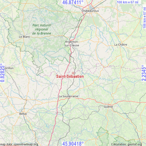
Saint-Sébastien GPS coordinates[2]
46° 23' 28.68" North, 1° 31' 52.932" East
| Map corner | latitude | longitude |
|---|---|---|
| Upper-left | 46.87411°, | 0.82825° |
| Center: | 46.3913°, | 1.53137° |
| Lower-right: | 45.90418°, | 2.2345° |
| Map W x H: | 107.8×107.8 km | = 67×67mi |
| max Lat: | 51.07786° ⇑61.2% North |
| Saint-Sébastien: | 46.3913° |
| min Lat: | ⇓38.8% South 41.3874° |
| min Long | Saint-Sébastie | max Long |
| -5.08615° | 1.53137° | 9.52242° |
| W 37.4%⇐ | ⇒62.6% E |
Elevation
Elevation of Saint-Sébastien is 305 m = 1001 ft, and this is 111.3 m = 365 ft above average elevation for this country.
| Max E: |
2333 m = 7654 ft | 18.5% |
| Saint-Sébastien | 305 m 1001 ft | |
| Avg. | 193.7 m = 635 ft | |
Min E: |
-1 m = -3 ft | 81.5% |
See also: France elevation on elevation.city.
Geographical zone
Saint-Sébastien is located in North temperate zone (between Tropic of Cancer and the Arctic Circle). Distance of this North polar circle is 2242.9 km =1393.7 mi to North.| Distance of | km | miles | from Saint-Sébastien |
|---|---|---|---|
| North Pole | 4848.8 | 3012.9 | to North |
| Arctic Circle | 2242.9 | 1393.7 | to North |
| Tropic Cancer | 2552.3 | 1585.9 | to South |
| Equator | 5158.2 | 3205.2 | to South |


Nearby cities:
15 places around Saint-Sébastien: (largest is in red/bold)
• Azerables
6.1 km =3.8 mi,  226°
226°
• Ceaulmont
15.1 km =9.4 mi,  13°
13°
• Chantôme
2.9 km =1.8 mi,  41°
41°
• Crozant
6.9 km =4.3 mi,  89°
89°
• Cuzion
11.4 km =7.1 mi,  30°
30°
• Dun-le-Palestel
14 km =8.7 mi,  132°
132°
• Fresselines
11.6 km =7.2 mi, 94°
• La Châtre-Langlin
11 km =6.8 mi,  280°
280°
• Naillat
16.3 km =10.1 mi,  150°
150°
• Orsennes
15 km =9.3 mi,  50°
50°
• Parnac
9.7 km =6 mi,  315°
315°
• Saint-Agnant-de-Versillat
12.6 km =7.8 mi,  187°
187°
• Saint-Benoît-du-Sault
12.1 km =7.5 mi,  296°
296°
• Saint-Sulpice-les-Feuilles
15 km =9.3 mi,  237°
237°
• Éguzon-Chantôme
7.6 km =4.7 mi, 31°
Sources, notices
• [Note1] Compared only with cities in France existing in our database
• [Src1] Map data: © OpenStreetMap contributors (CC-BY-SA)
• [Src2] Other city data from geonames.org with taken over terms of usage.
• [Src3] Geographical zone / Annual Mean Temperature by Robert A. Rohde @ Wikipedia
