La Châtre-Langlin geodata
La Châtre-Langlin (Centre) is a populated place; located in France in Europe/Paris (GMT+2) time zone. With population of 569 people, there are 13839 cities with bigger population in this country. Compared to other cities in France, 61% of cities are located further ↑North; 64.4% of cities are located further →East and 75.3% of cities have lower elevation than La Châtre-Langlin. Note1
Administrative division(s):
- Level 1: Centre
- Level 2: Département de l'Indre
- Level 3: Le Blanc
- Level 4: La Châtre-Langlin


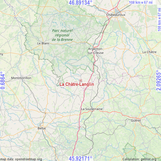
La Châtre-Langlin GPS coordinates[2]
46° 24' 31.248" North, 1° 23' 22.272" East
| Map corner | latitude | longitude |
|---|---|---|
| Upper-left | 46.89134°, | 0.6864° |
| Center: | 46.40868°, | 1.38952° |
| Lower-right: | 45.92171°, | 2.09265° |
| Map W x H: | 107.8×107.8 km | = 67×67mi |
| max Lat: | 51.07786° ⇑61% North |
| La Châtre-Langlin: | 46.40868° |
| min Lat: | ⇓39% South 41.3874° |
| min Long | La Châtre-Lang | max Long |
| -5.08615° | 1.38952° | 9.52242° |
| W 35.6%⇐ | ⇒64.4% E |
Elevation
Elevation of La Châtre-Langlin is 251 m = 823 ft, and this is 57.3 m = 188 ft above average elevation for this country.
| Max E: |
2333 m = 7654 ft | 24.7% |
| La Châtre-Langlin | 251 m 823 ft | |
| Avg. | 193.7 m = 635 ft | |
Min E: |
-1 m = -3 ft | 75.3% |
See also: France elevation on elevation.city.
Geographical zone
La Châtre-Langlin is located in North temperate zone (between Tropic of Cancer and the Arctic Circle). Distance of this North polar circle is 2241 km =1392.5 mi to North.| Distance of | km | miles | from La Châtre-Langlin |
|---|---|---|---|
| North Pole | 4846.9 | 3011.7 | to North |
| Arctic Circle | 2241 | 1392.5 | to North |
| Tropic Cancer | 2554.2 | 1587.1 | to South |
| Equator | 5160.2 | 3206.4 | to South |


Nearby cities:
15 places around La Châtre-Langlin: (largest is in red/bold)
• Arnac-la-Poste
15.9 km =9.9 mi,  184°
184°
• Azerables
8.9 km =5.5 mi,  133°
133°
• Chaillac
7.5 km =4.7 mi,  291°
291°
• Chantôme
12.8 km =8 mi,  89°
89°
• Crozant
17.9 km =11.1 mi,  95°
95°
• Lignac
14.6 km =9.1 mi,  295°
295°
• Lussac-les-Églises
18 km =11.2 mi,  246°
246°
• Parnac
6.4 km =4 mi,  39°
39°
• Prissac
12.9 km =8 mi,  331°
331°
• Saint-Agnant-de-Versillat
17.2 km =10.7 mi,  147°
147°
• Saint-Benoît-du-Sault
3.5 km =2.2 mi,  1°
1°
• Saint-Léger-Magnazeix
17.3 km =10.7 mi,  219°
219°
• Saint-Sulpice-les-Feuilles
10.2 km =6.3 mi,  189°
189°
• Saint-Sébastien
11 km =6.8 mi, 100°
• Éguzon-Chantôme
15.5 km =9.6 mi,  72°
72°
Sources, notices
• [Note1] Compared only with cities in France existing in our database
• [Src1] Map data: © OpenStreetMap contributors (CC-BY-SA)
• [Src2] Other city data from geonames.org with taken over terms of usage.
• [Src3] Geographical zone / Annual Mean Temperature by Robert A. Rohde @ Wikipedia
