Saint-Sulpice-les-Feuilles geodata
Saint-Sulpice-les-Feuilles (Nouvelle-Aquitaine) is a populated place; located in France in Europe/Paris (GMT+2) time zone. With population of 1,262 people, there are 7220 cities with bigger population in this country. Compared to other cities in France, 62.1% of cities are located further ↑North; 64.8% of cities are located further →East and 79.9% of cities have lower elevation than Saint-Sulpice-les-Feuilles. Note1
Administrative division(s):
- Level 1: Nouvelle-Aquitaine
- Level 2: Haute-Vienne
- Level 3: Arrondissement de Bellac
- Level 4: Saint-Sulpice-les-Feuilles
Current local time in Saint-Sulpice-les-Feuilles:
08:08 AM, SaturdayDifference from your time zone: hours


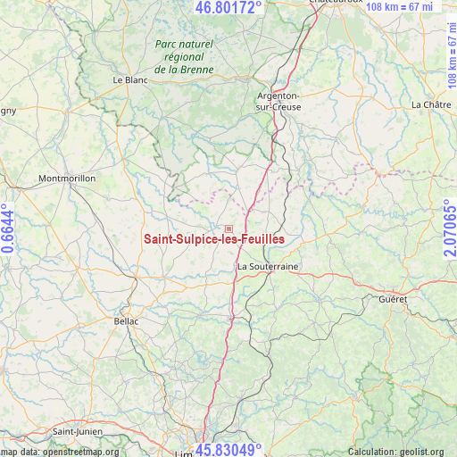
Saint-Sulpice-les-Feuilles GPS coordinates[2]
46° 19' 5.736" North, 1° 22' 3.108" East
| Map corner | latitude | longitude |
|---|---|---|
| Upper-left | 46.80172°, | 0.6644° |
| Center: | 46.31826°, | 1.36753° |
| Lower-right: | 45.83049°, | 2.07065° |
| Map W x H: | 108×108 km | = 67.1×67.1mi |
| max Lat: | 51.07786° ⇑62.1% North |
| Saint-Sulpice-les-Feuilles: | 46.31826° |
| min Lat: | ⇓37.9% South 41.3874° |
| min Long | Saint-Sulpice-l | max Long |
| -5.08615° | 1.36753° | 9.52242° |
| W 35.2%⇐ | ⇒64.8% E |
Elevation
Elevation of Saint-Sulpice-les-Feuilles is 289 m = 948 ft, and this is 95.3 m = 313 ft above average elevation for this country.
| Max E: |
2333 m = 7654 ft | 20.1% |
| Saint-Sulpice-les-Feuilles | 289 m 948 ft | |
| Avg. | 193.7 m = 635 ft | |
Min E: |
-1 m = -3 ft | 79.9% |
See also: France elevation on elevation.city.
Geographical zone
Saint-Sulpice-les-Feuilles is located in North temperate zone (between Tropic of Cancer and the Arctic Circle). Distance of this North polar circle is 2251.1 km =1398.8 mi to North.| Distance of | km | miles | from Saint-Sulpice-les-Feuilles |
|---|---|---|---|
| North Pole | 4857 | 3018 | to North |
| Arctic Circle | 2251.1 | 1398.8 | to North |
| Tropic Cancer | 2544.2 | 1580.9 | to South |
| Equator | 5150.1 | 3200.1 | to South |


Nearby cities:
15 places around Saint-Sulpice-les-Feuilles: (largest is in red/bold)
• Arnac-la-Poste
5.8 km =3.6 mi,  175°
175°
• Azerables
9.1 km =5.7 mi,  64°
64°
• Chaillac
13.9 km =8.6 mi,  337°
337°
• Chantôme
17.7 km =11 mi,  54°
54°
• Fromental
17.8 km =11.1 mi,  172°
172°
• La Châtre-Langlin
10.2 km =6.3 mi,  9°
9°
• La Souterraine
12.8 km =8 mi,  134°
134°
• Lussac-les-Églises
15.1 km =9.4 mi,  281°
281°
• Parnac
16.1 km =10 mi,  20°
20°
• Saint-Agnant-de-Versillat
11.8 km =7.3 mi,  111°
111°
• Saint-Benoît-du-Sault
13.7 km =8.5 mi, 7°
• Saint-Léger-Magnazeix
9.9 km =6.2 mi,  249°
249°
• Saint-Maurice-la-Souterraine
12.5 km =7.8 mi,  157°
157°
• Saint-Sornin-Leulac
14.3 km =8.9 mi,  202°
202°
• Saint-Sébastien
15 km =9.3 mi, 57°
Sources, notices
• [Note1] Compared only with cities in France existing in our database
• [Src1] Map data: © OpenStreetMap contributors (CC-BY-SA)
• [Src2] Other city data from geonames.org with taken over terms of usage.
• [Src3] Geographical zone / Annual Mean Temperature by Robert A. Rohde @ Wikipedia
