Saint-Agnant-de-Versillat geodata
Saint-Agnant-de-Versillat (Nouvelle-Aquitaine) is a populated place; located in France in Europe/Paris (GMT+2) time zone. With population of 1,098 people, there are 8143 cities with bigger population in this country. Compared to other cities in France, 62.6% of cities are located further ↑North; 62.9% of cities are located further →East and 81.9% of cities have lower elevation than Saint-Agnant-de-Versillat. Note1
Administrative division(s):
- Level 1: Nouvelle-Aquitaine
- Level 2: Creuse
- Level 3: Arrondissement de Guéret
- Level 4: Saint-Agnant-de-Versillat
Current local time in Saint-Agnant-de-Versillat:
08:38 AM, SaturdayDifference from your time zone: hours


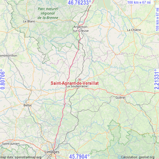
Saint-Agnant-de-Versillat GPS coordinates[2]
46° 16' 42.672" North, 1° 30' 36.684" East
| Map corner | latitude | longitude |
|---|---|---|
| Upper-left | 46.76233°, | 0.80706° |
| Center: | 46.27852°, | 1.51019° |
| Lower-right: | 45.7904°, | 2.21331° |
| Map W x H: | 108.1×108.1 km | = 67.2×67.2mi |
| max Lat: | 51.07786° ⇑62.6% North |
| Saint-Agnant-de-Versillat: | 46.27852° |
| min Lat: | ⇓37.4% South 41.3874° |
| min Long | Saint-Agnant-de | max Long |
| -5.08615° | 1.51019° | 9.52242° |
| W 37.1%⇐ | ⇒62.9% E |
Elevation
Elevation of Saint-Agnant-de-Versillat is 310 m = 1017 ft, and this is 116.3 m = 382 ft above average elevation for this country.
| Max E: |
2333 m = 7654 ft | 18.1% |
| Saint-Agnant-de-Versillat | 310 m 1017 ft | |
| Avg. | 193.7 m = 635 ft | |
Min E: |
-1 m = -3 ft | 81.9% |
See also: France elevation on elevation.city.
Geographical zone
Saint-Agnant-de-Versillat is located in North temperate zone (between Tropic of Cancer and the Arctic Circle). Distance of this North polar circle is 2255.5 km =1401.5 mi to North.| Distance of | km | miles | from Saint-Agnant-de-Versillat |
|---|---|---|---|
| North Pole | 4861.4 | 3020.7 | to North |
| Arctic Circle | 2255.5 | 1401.5 | to North |
| Tropic Cancer | 2539.8 | 1578.2 | to South |
| Equator | 5145.7 | 3197.4 | to South |


Nearby cities:
15 places around Saint-Agnant-de-Versillat: (largest is in red/bold)
• Arnac-la-Poste
10.6 km =6.6 mi,  262°
262°
• Azerables
8.8 km =5.5 mi,  341°
341°
• Chantôme
15.1 km =9.4 mi,  13°
13°
• Crozant
15.2 km =9.4 mi,  34°
34°
• Dun-le-Palestel
12.3 km =7.6 mi,  75°
75°
• Fromental
15.8 km =9.8 mi,  213°
213°
• La Souterraine
4.9 km =3 mi,  202°
202°
• Le Grand-Bourg
16.7 km =10.4 mi,  141°
141°
• Naillat
9.9 km =6.2 mi,  99°
99°
• Saint-Maurice-la-Souterraine
9.5 km =5.9 mi,  220°
220°
• Saint-Pierre-de-Fursac
14.6 km =9.1 mi,  179°
179°
• Saint-Priest-la-Feuille
8.8 km =5.5 mi,  167°
167°
• Saint-Sulpice-les-Feuilles
11.8 km =7.3 mi,  291°
291°
• Saint-Sébastien
12.6 km =7.8 mi, 7°
• Saint-Étienne-de-Fursac
14.9 km =9.3 mi, 178°
Sources, notices
• [Note1] Compared only with cities in France existing in our database
• [Src1] Map data: © OpenStreetMap contributors (CC-BY-SA)
• [Src2] Other city data from geonames.org with taken over terms of usage.
• [Src3] Geographical zone / Annual Mean Temperature by Robert A. Rohde @ Wikipedia
